


DECATUR, IL. (WAND) - Happy Tuesday! The first true heat wave of the season arrives this afternoon. It was a very damp start to the week, with most of the area seeing an inch or more of rain. Over 4 inches of rain fell in Mattoon alone. The rain has moved out of the area with just a few scattered showers in the area today.
The heat and humidity will take over this afternoon. Temperatures will climb into the upper 80s this afternoon. The heat index will make it feel closer to 100 degrees. A few isolated storms will be possible through the evening, but most of the area will stay dry.
Wednesday will be the hottest day of the week. Temperatures will soar into the low 90s by the afternoon with a heat index over 100 degrees. This could help fuel another round of storms for the evening. The severe weather threat with these storms will be mostly focused on the gusty winds. The bulk of the severe weather should stay to the north.
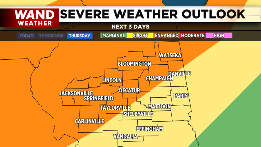
Thursday is the most complicated day of the week in terms of severe weather threats. Temperatures will once again push into the 90s by Thursday afternoon, and this will again help fuel some potential storms. An organized line of storms is expected to push through Central Illinois on Thursday evening. All modes of severe weather are possible in this system, including tornadoes. The storms will exit overnight, and much cooler and drier air will move in behind the front.
Copyright 2026. WANDTV. All Rights Reserved.


