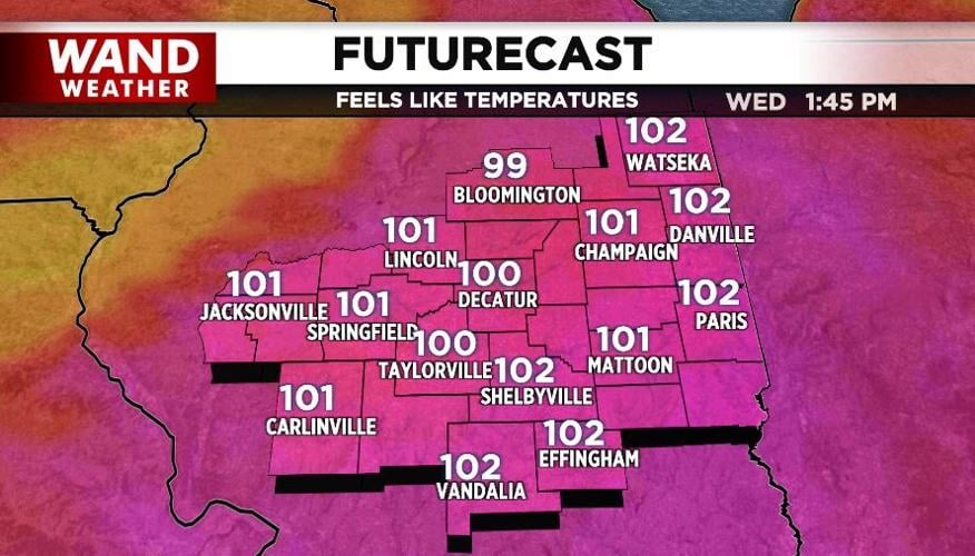


DECATUR, Ill. (WAND) - The first 100-degree FeelsLike temperatures are headed to the area after today's "cool down." It didn't really feel cool given the super high humidity, but the combo of rain and more clouds than sun led to lower temperatures when compared to this past weekend.
Some of the earlier storms produced flooding and funnel clouds. While there are areas of standing water lingering across the state, that should settle down later tonight as the coverage area of thunderstorms diminishes.
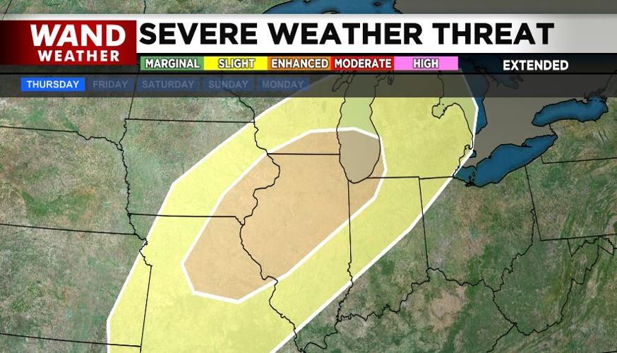
Tuesday will likely be a less active day overall, but thunderstorms will redevelop for some. The time frame after midnight Wednesday night (early Thursday morning) will need to be monitored for potential severe weather dropping in from the northwest. If that weren't enough, tornadoes may accompany some of the storms Thursday evening and Thursday.
There's plenty of time to make severe weather preparations, including how you will get notified if a severe storm approaches during the wee hours of the morning.
Stay safe and stay weather-aware.
Copyright 2026. WANDTV. All Rights Reserved.


