
DECATUR, Ill. (WAND) - For some, this is the third round of accumulating snow if you recall the early November lake effect event. For most, it's the second round of snow within 48 hours!
This batch of snow is far different in texture compared to its predecessor. It is lighter and flurry; kind of a powdery snow that you cannot make a snowball out of. Nonetheless, slippery travel will be had for all where roads are not treated over and over again.
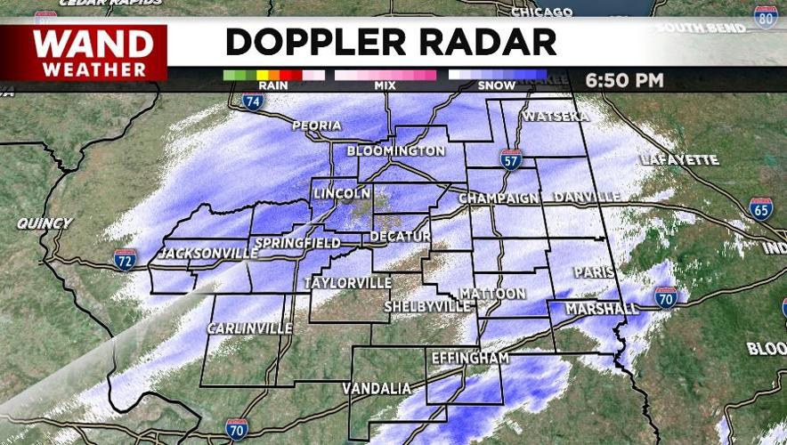
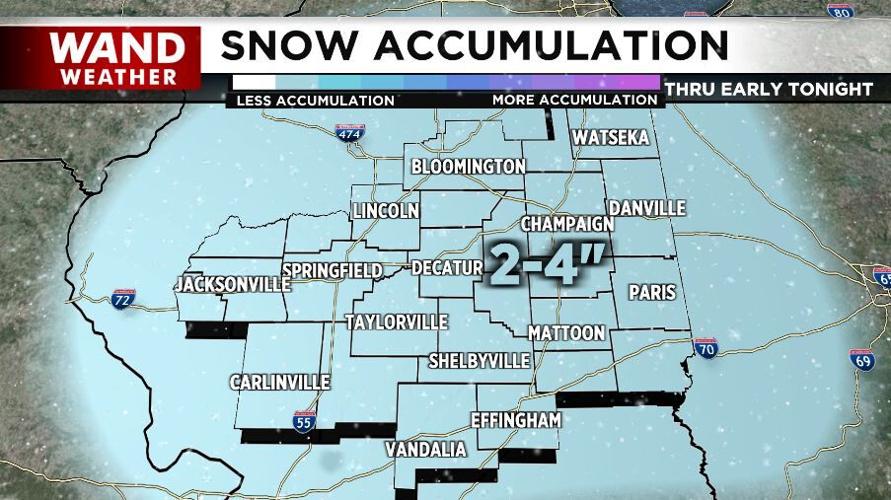
This storm will wind down in the accumulation department rapidly from west-northwest to east-southeast early tonight. The accumulation map shows a general accumulation of two to four inches. However, a couple locales in the heavier bands of snow, denoted by the darker shading on Doppler radar, can pick up just over four inches.
If that weren't enough, an inversion will be in play again tomorrow. With warm air above the cold, snowy ground, clouds can easily persist all day. There will be a brief "warm up" Won ednesday before we challenge record cold later in the week.
Stay warm, stay safe, stay weather-aware.
Copyright 2025. WANDTV. All Rights Reserved.


