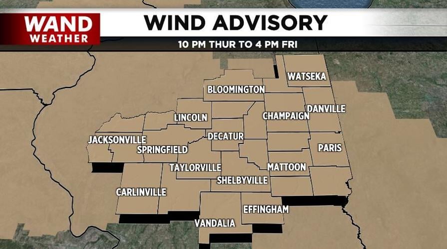


DECATUR, Ill. (WAND) - Tranquil days of late are few and far between. Yes, windy weather is headed back into the picture. However, this isn't your typical gusty wind.
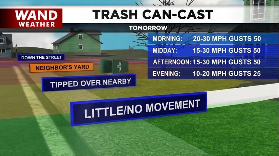
A clipper (fast-moving storm) will skirt central Illinois to the north tonight into Friday. While only a few sprinkles are likely given the depth of dry air above our heads, that isn't the main feature associated with this storm. It's the wind. Big time! Wind develops from a change in pressure. Greater the pressure change, greater the wind speed.
This intense clipper will usher in wind gusts of over 40-50 mph. That's strong enough to do minor damage to tree limbs. That, in turn, can create issues with power, your place of residence and vehicle. The criteria for a severe storm is 58+ mph. These gusts are just a notch below that.
If you want to be a glass-half-full person, this type of wind allows wind turbines to operate at near maximum capacity, typically 1.5 to 3.6 megawatts per turbine. At this speed, a single utility-scale turbine can power hundreds of homes.
Stay safe and stay weather-aware.
Copyright 2026. WANDTV. All Rights Reserved.


