(WAND) - Wednesday provides another opportunity of strong winds with gusts upwards of 50 miles per hour at times.
This has led to National Weather Service to issue a Wind Advisory until 7 a.m. Thursday.

On top of this, due to recent drought issues, a Red Flag Warning is also in effect today until 7 p.m. tonight. Central Illinoisans are urged to avoid burning as strong winds and dry conditions could cause fires to spread very quickly.
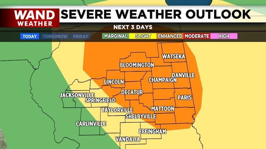
In addition, there is an Enhanced Risk (Level 3) for Severe Weather Wednesday afternoon from 2 p.m. until 6 p.m.
The atmosphere has provided volatile conditions to allow for strong and severe storms to develop quickly causing issues the further Northeast you live.
The biggest threat remains high winds (60+ mph), although hail and even tornadic activity cannot be ruled out.
The coverage area remains isolated and more likely near the I-74 corridor.
WAND Meteorologists are tracking the storms and will continue to provide the latest on their development.
Copyright 2025 WAND TV. All rights reserved.