
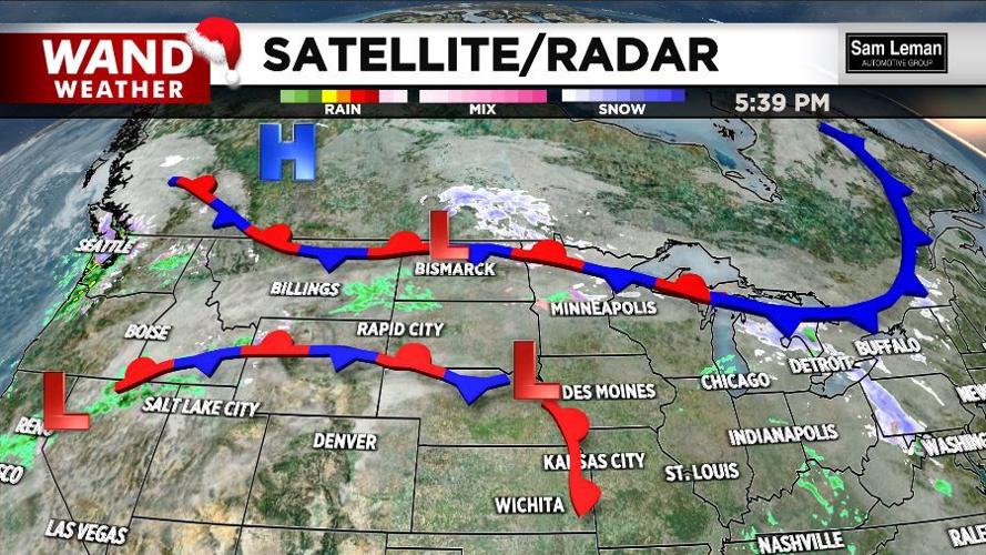
DECATUR, Ill. (WAND) - A couple waves of low pressure, albeit fairly weak, will traipse west to east across the region this Christmas week.
These waves may spark an occasional shower or spot of drizzle, but no wash-out or heavy rain is expected. Much of this week will remain dry and mild.
Wind flow around low pressure areas is counter-clockwise. So, as these weak waves of low pressure arrive, then depart, we will encounter a shift in wind direction. Factor in an inversion, where warm air resides on top of cooler air at the ground, for a couple days. The end result will be quite a bit of cloud cover. The combo of this cloud cover and a breeze out of the northeast does not argue for a record warm Christmas. It will still be mild, just not a record-breaker.
The only way we can make a case for a record is if the wind and source region for our air mass return from the southwest. That may very well happen this week, but it is looking more and more like Friday and Saturday.
Ahh, the weather, it's always changing!
Stay tuned, and stay safe. Enjoy the warmth and the holiday season.
Copyright 2025. WANDTV. All Rights Reserved.