
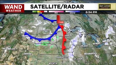
DECATUR, Ill. (WAND) - A warm front precedes a pair of cold fronts. Each feature will bring some snow to the region. The biggest accumulation, and it isn't much, occurs tonight in advance of the warm front to our west. A coating to an inch or two of powdery snow will fall, leading to slippery travel.
Snow will taper to flurries before daybreak Friday, then melt as gusty winds aid in the development of somewhat milder weather. Fortunate or not, that milder air is a one-hit wonder.
The first of two cold fronts will arrive Friday evening with snow showers that can coat the ground in spots. If there is initial melting with temperatures near freezing, then black ice is a possibility later on as colder air moves in.
The second cold front arrives Saturday to enhance the depth of cold air and provide a passing flurry or two.
Bundle up, stay safe on the roads, make some chili and remain weather-aware.
Copyright 2026. WANDTV. All Rights Reserved.