
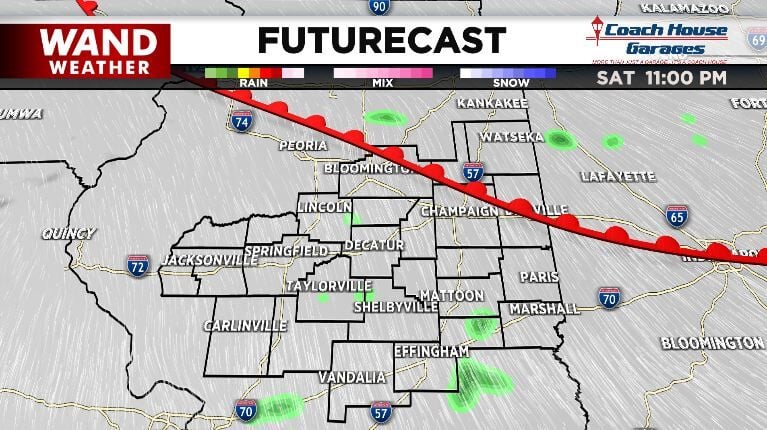
Sunday brings some wild weather to our area as a strong low pressure system swings through. First up, the leading warm front lifts across our communities Saturday night. This opens us up to warmer, more humid air and ushers in the start of our rain.
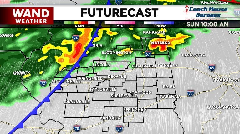
While the rain starts light overnight, it gets heavier by Sunday morning starting in our northern communities. We need that rain; our area is still fully engulfed in drought conditions according to the latest update from the U.S. Drought Monitor.
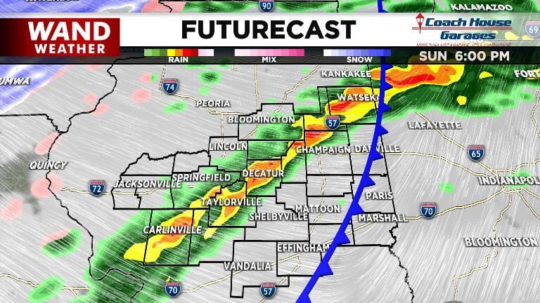
As the cold front passes through our area later in the day, it provides an extra spark of energy that could set off some stronger storms.

There is a low level threat those storms could become severe and bring damaging wind gusts and isolated tornadoes along with the quick bursts of heavy rain and thunder and lightning we are expecting. That is why the Storm Prediction Center has issued their lowest level risk (Marginal - level 1 of 5) for our area Sunday.
Behind that cold front, temperatures drop significantly. We will hit a high temperature in the middle 60s early in the day Sunday before dropping to a low temperature in the teens (with a wind chill in the single digits) by Monday morning.
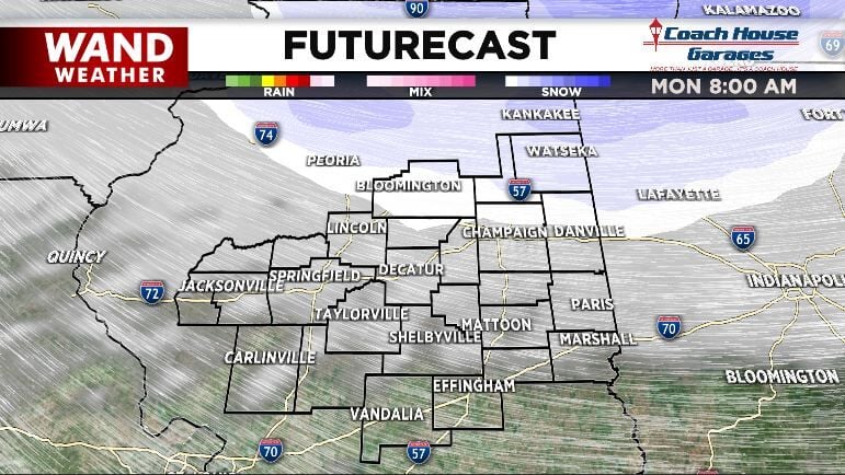
With temperatures dropping so far so fast, a flash freeze will be possible Monday morning. That is not a scare-tactic; it is a real weather phenomenon where any untreated water on roads, sidewalks, etc. freezes instantly as the temperature drops. We may have slick spots develop in our area before your Monday morning commute, so make plans to check in with WAND Wakeup Monday morning before hitting the road.


