These nice, mild temperatures and dry conditions will continue through the middle of the week ahead, so let's talk about why. We all know the weather in central Illinois changes frequently, so what is keeping our weather so stable for a week?
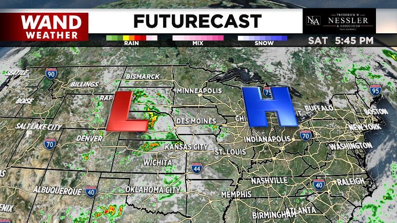
The big blue H in the map above represents an area of high pressure. Much of weather forecasting centers around tracking how and why air pressure changes because that influences what the weather will do. Think about putting your hands on a table and pressing down - you are applying a higher amount of pressure to that table by pressing down. The air is doing the same thing to to earth this week! Around an area of high pressure, the air is sinking, pressing down on the earth. Sinking air (stability) generally leads to clear sky and quiet conditions because you need rising air (instability) to get rain and storms.
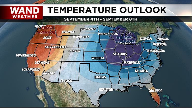
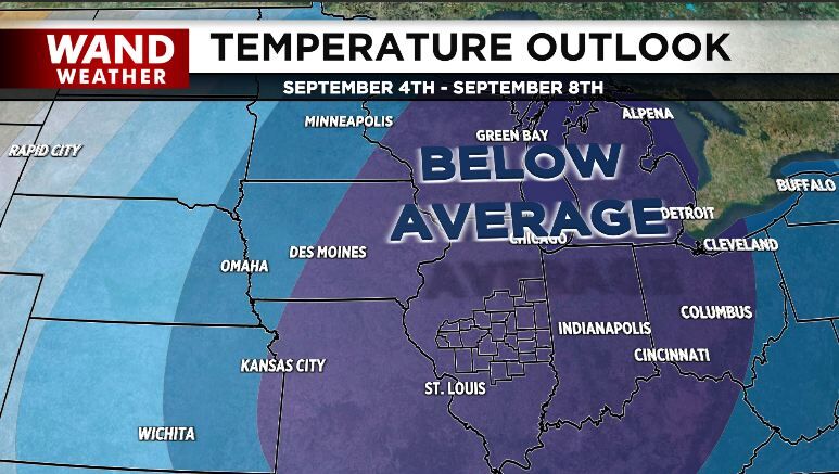
It's not until Wednesday that a cold front arrives interrupting this pattern by bringing rain and a drop in temperature. The Climate Prediction Center shows a high likelihood of temperatures being below normal 6-10 days from now. At the start of September, average high temperatures are in the lower 80s and average low temperatures are in the low 60s, so this map is suggesting we will be cooler than that at the start of the month.