

(WAND) - A few eastern locales are waking up early this morning to patchy fog which will luckily burn off by or after sunrise.
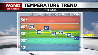
The clouds leftover from Wednesday's storm will linger throughout the morning with sunshine forecasted by the afternoon. Temperatures across the region will be above average in the mid 40s.

Mostly clear skies and mid 20s are in store for tonight while skies turn partly sunny on Friday, with seasonable highs in the upper 30s.
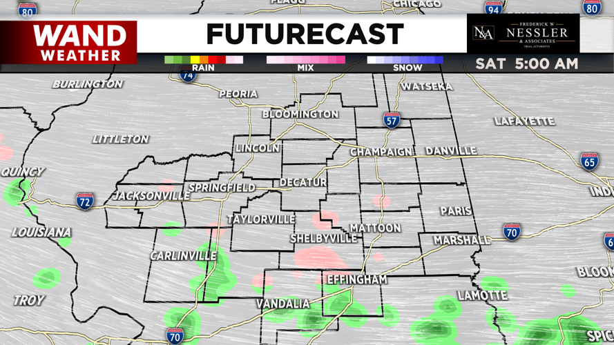
A new system arrives late Friday night that could start as a wintry mix or freezing rain before changing to rain. The rain will be scattered throughout the day on Saturday, with highs in the low 40s.
Conditions turn chillier starting Sunday which will continue into the next workweek.
Dry conditions are in store for Sunday and Monday, with more clouds on Sunday. Highs will be above freezing for both Sunday and Monday at or near average in the mid to upper 30s.
Temperatures trend down towards the freezing mark on Tuesday in the low 30s and near 30° by Wednesday. Both of these days have the chance of snow showers across central Illinois.
Meteorologist Ulises Garcia
Copyright 2025 WAND TV. All rights reserved.


