


(WAND) - Winter is making a strong presence across central Illinois this week.
Highs starting today through Thursday will be in the teens. Nighttime lows will be in the single digits through Saturday morning, with Wednesday and Thursday nights dropping at or below zero.

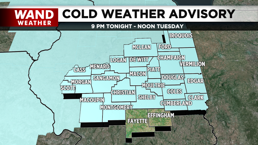
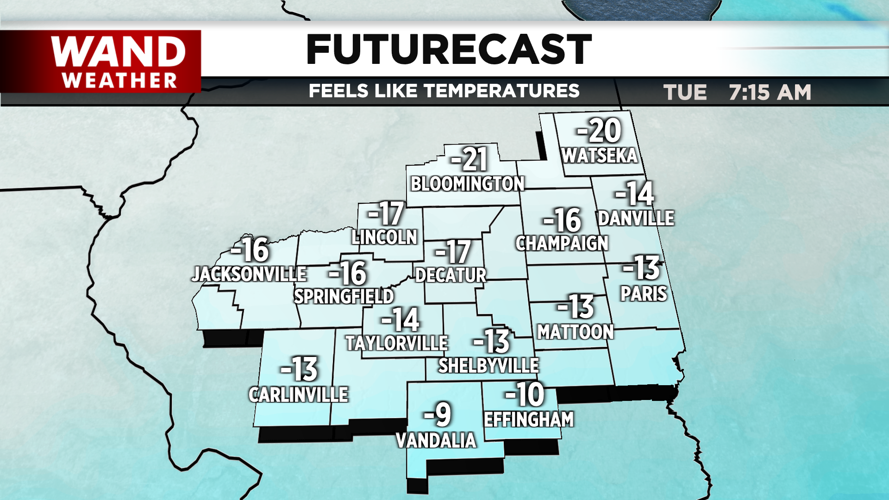
A Cold Weather Advisory is in effect for almost all of central Illinois for tonight through noon on Tuesday. Feels like temperatures for tonight and Tuesday morning could reach as low as -20°. Multiple nights with a Cold Weather Advisory are a good possibility throughout this week.

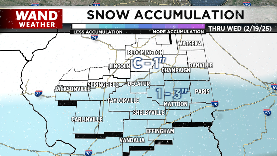
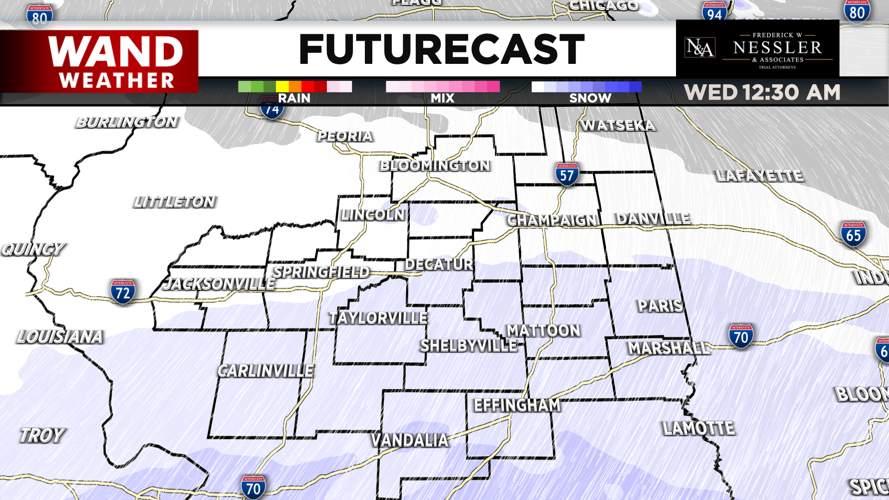
Spotty snow chances are possible for late today and tonight across the region. However, the best chance for accumulating snowfall will be Tuesday night. Snowfall amounts will be mostly between 1-3 inches south of I-72; with higher totals towards I-70.

The second half of the week and weekend are trending dry. Temperatures do make a gradual warm-up into the weekend, but it will still remain below average, even by Sunday. Luckily, above freezing temperatures are forecasted to arrive across the region by Sunday.

Meteorologist Ulises Garcia
Copyright 2025 WAND TV. All rights reserved.