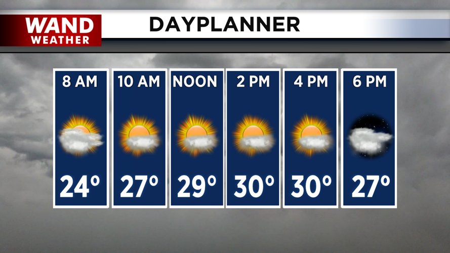

DECATUR, IL. (WAND) - Happy Monday! The bitter cold will finally break slightly this afternoon as temperatures climb into the low 30s. Expect a gloomy morning with mostly cloudy skies before a little sunshine peaks through this afternoon. Temperatures will be slightly below average but significantly warmer than those we have seen in the last two weeks.

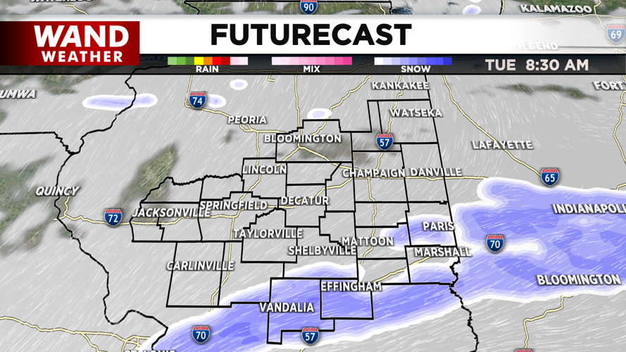
Overnight lows will drop into the low 20s with clouds building back into the region. Another shot of some light snow moves in overnight into early Tuesday morning. There is still some uncertainty with this event, as some models show snow staying south of I-70. There is a chance that a band of snow forms with this event and produces more than an inch of snow, but generally, the I-72 corridor will only see a light dusting.

The track of this system could still change, so stay tuned for updates throughout the day. Overnight lows for the middle of the week will be heavily influenced by cloud cover. More clouds mean warmer overnight lows, and we expect to have some cloud cover through the middle of the week.
A late-week clipper system could bring in another shot of snow to northern Illinois, but it looks like it will miss Central Illinois. Temperatures appear to be much warmer next week.
Copyright 2026. WANDTV. All Rights Reserved.


