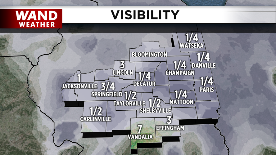


DECATUR, IL. (WAND) - Happy Friday! It’s another foggy and gloomy start to the day across much of Central Illinois, but the fog won’t last as long today. A warm front is lifting across the region through the morning. This will bring in much warmer temperatures and gusty winds that will help the fog dissipate quickly. Temperatures will soar into the 70s this afternoon, making it the warmest day of the year so far.
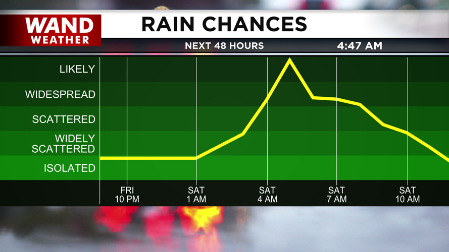
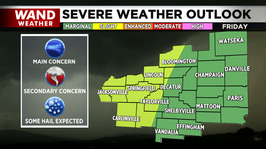
A few scattered showers and pop-up storms are possible through the afternoon, but most of the area will stay dry today. Better storm chances will arrive tonight as a cold front sweeps in from the northwest. These storms could hit severe limits early Saturday morning. The main threat with these storms will be very strong wind gusts, but isolated tornadoes are also possible. Areas west of I-57 have the best chance for severe storms to develop.


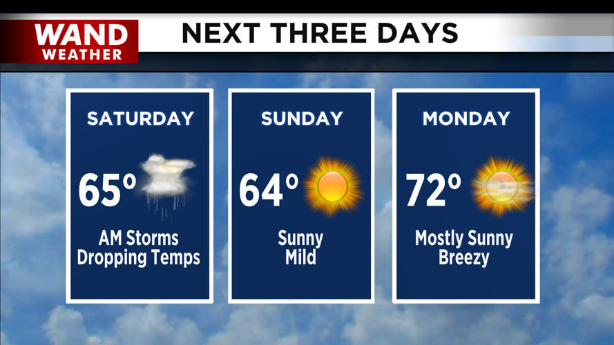
Storms will exit the area before noon. Temperatures will fall throughout the day on Saturday behind the storms. Afternoon temperatures will be mild in the 50s. Much warmer temperatures arrive for early next week with highs in the mid to upper 60s on Sunday.

Another round of showers and storms is expected for the middle of next week. Have a great weekend!
Copyright 2026. WANDTV. All Rights Reserved.


