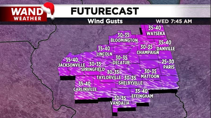

DECATUR, Ill. (WAND) - The first clipper storm of the week is history outside of a passing flurry tonight. Its associated wind, which tipped the scales at 58 mph in Springfield, is also on the wane tonight.
However, the cold air arriving is only the tip of the iceberg.
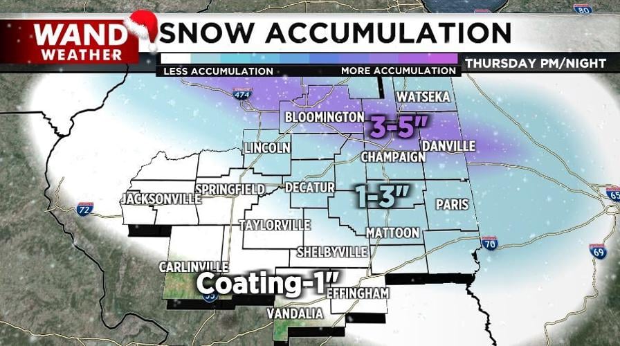
A pocket of drier air above our heads arrives with the colder weather tonight. That means our next clipper will have to fight off that drier air to eventually bring accumulating snow our way. That will happen, but not until later Thursday. Any flurries before 5 p.m. will be limited.
The true accumulation will be shortly thereafter. The storm track will be oriented west-northwest to east-northeast. That's a given. The question mark is where the heavier band of 3-5" accumulation sets up.
Right now, the WAND weather team believes it will be close to I-74. However, a small shift in storm storm by 20 miles can mean the difference between an inch and four inches. Now, this storm will be winding down quickly near and just after midnight Thursday night. A couple hours of heavier snow will make travel a bit difficult in spots.
If this weren't enough, another accumulating storm will arrive Saturday. Dangerous cold will follow for the remainder of the weekend.
Stay safe, stay warm and stay weather-aware.
Copyright 2025. WANDTV. All Rights Reserved.


