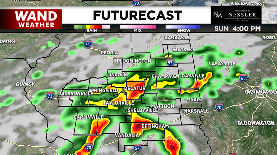

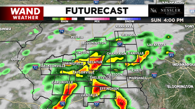
Our cold front is slow to exit the region this weekend, giving us another day of showers and storms today.
We start the day with clouds building in early, and by midday, isolated showers will already be rolling in. Showers and storms will becoming more scattered to widespread by the early afternoon, with a few heavy downpours possible. Some of these showers may linger as late as into this evening.
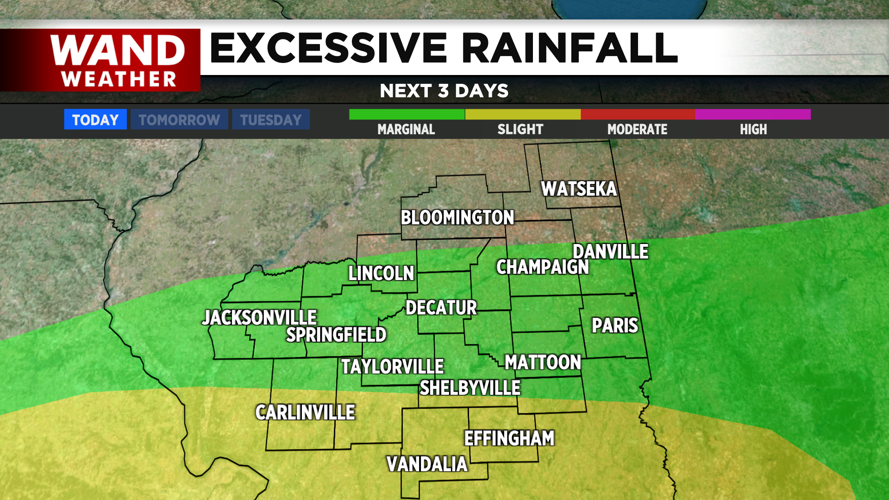
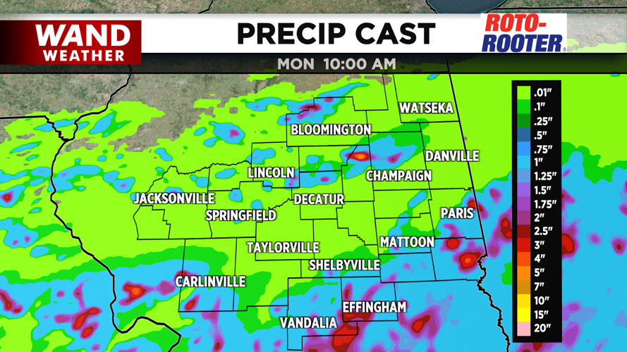
The I-70 corridor will likely see stronger thunderstorms develop where moisture has been plentiful all morning. This may lead to heavy downpours and gusty winds. Much of south-central and southern Illinois will lean over an inch of rainfall, with local amounts up to 2.5 inches where the heaviest rain sets up.

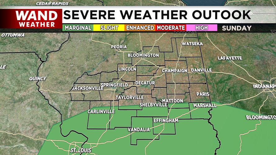
This has left the southern half of the region under a risk for flash flooding, with counties as far north as Shelby, Cumberland, and Macoupin all under a slight (level 2 out of 4) risk. The same areas under the slight risk for flash flooding are also under a marginal risk for severe thunderstorms.


Temperatures today will be on the milder side with highs in the low 80s and lows in the upper 60s, but dewpoints in the low 70s will keep us feeling warm and humid.


