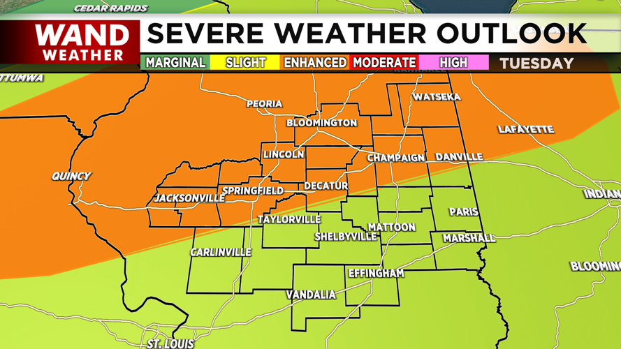
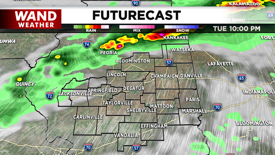
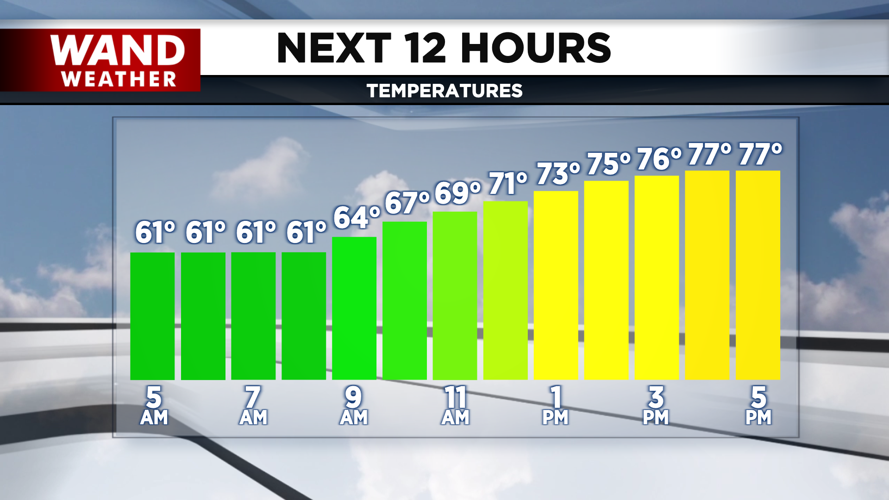


DECATUR, IL. (WAND) - Happy Tuesday! We have another warm day ahead that leads to severe weather chances later this evening and overnight. Temperatures this afternoon will be close to record-breaking in the upper 70s as a warm front lifts northward across Central Illinois. Expect mostly cloudy skies and gusty winds, but most of the area will be dry through the afternoon.

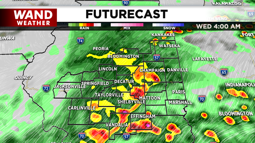
Isolated storms will be possible through the early evening as the warm front moves across the region, but most of the area will be dry most of the day. An approaching cold front will trigger strong storms overnight. All modes of severe weather will be possible, but the tornado and hail risk are the two biggest concerns. Combined with very strong wind gusts, there could be a risk for some power outages through the overnight hours into Wednesday morning.


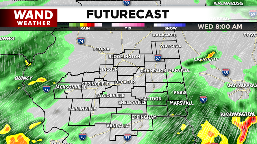
The strongest storms are expected to occur very early Wednesday morning. Between midnight and 6 am, the strongest storms will occur. Showers and storms will linger in the area through noon. Temperatures will fall throughout the day behind the front. Calmer conditions will return through the end of the week.
Copyright 2026. WANDTV. All Rights Reserved.


