


A stray shower is possible for western portions of central Illinois for this morning, with the rest of Sunday being partly cloudy to mostly sunny. Southeasterly winds up to 15 mph will bring our temperatures back to average to near 70° for this afternoon.
A milder night is in store for the area, under partly cloudy skies and lows in the low 50s. Monday will be much warmer; as highs soar into the low to mid 80s, thanks to breezy southerly winds. This will also lead to an increase in humidity across the region, making it feel muggy.
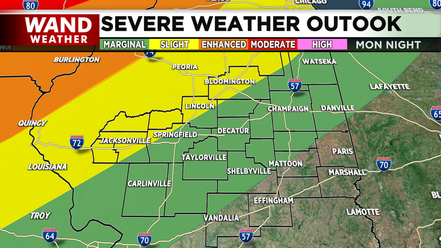
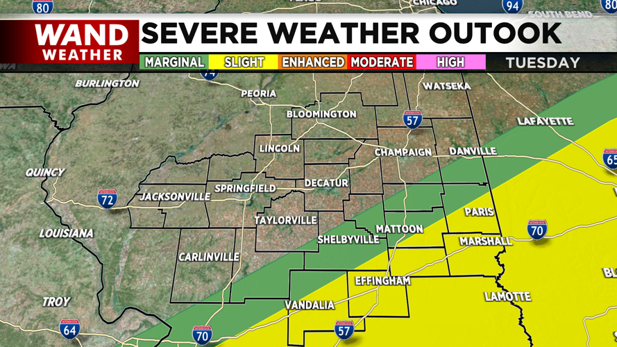
A few showers and storms are possible during the overnight hours on Tuesday especially for western communities; which will gradually shift south towards I-70 during the day on Tuesday. Areas west of I-55 are under a Slight (Level 2) risk for late Monday night; while communities along I-70 are placed within a Slight (Level 2) risk on Tuesday. The main threats will be wind and hail, but an isolated tornado is possible.
Wednesday and Thursday will remain unsettled with showers likely and a few storms possible on Thursday. Drier weather returns for Friday and Saturday. Highs from Wednesday through Saturday will be seasonable in the low 70s.
Meteorologist Ulises Garcia
Copyright 2025. WAND TV. All rights reserved.


