
(WAND) - Aerial photos show the massive damage and flooding left to the Bahamas after Hurricane Dorian tore through the islands.
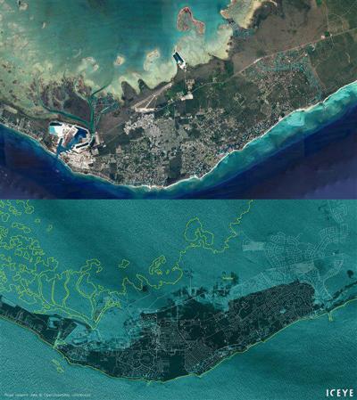
The photo shows a satellite google image of what the area looked like before Dorian arrived. The bottom is what it looks like now with heavy flooding. The yellow outline is where the island was before the storm.

Google Earth / ICEYE
Prime Minister Hubert Minnis toured Abaco Island and said, "the airport was underwater, with the runway completely flooded."
"The area around the airport now looks like a lake," said Minnis, who added: "We are in the midst of the greatest national crisis in our country's history."
Two more people died at hospitals, raising the death toll to seven.


