
(WAND) - Another warm winter week is on tap for Central Illinois.
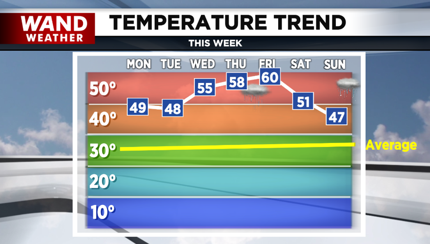
After a great weekend, the dry weather continues into Wednesday. Highs today and tomorrow will top out near 50° again.
Dense fog is possible Monday night into Tuesday morning as lows drop back into the 20s.
It really warms up for the middle and end of the week with highs in the 50s Wednesday and near 60° Thursday and Friday.

Rain chances return Thursday afternoon into Friday morning. A rumble or two of thunder can't be ruled out.
It'll cool off into the weekend, but it'll still be warmer than average. Highs Saturday will be in the low-50s with upper-40s Sunday.
Some models are hinting at rain Sunday with a wintry mix possible at night. Others keep it dry.
Meteorologist Anthony Peoples
Copyright 2024 WAND TV. All rights reserved.


