
(WAND) - Several rounds of severe weather are possible for central Illinois.
A line of storms moving across the area this morning prompted many severe thunderstorm and tornado warnings across Missouri. That line continued to weaken as it moved across central Illinois through late morning.

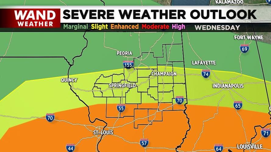
Wednesday's severe weather outlook
Some strong to severe storms are possible this afternoon with several counties on the eastern edge of our viewing area in a Tornado Watch until 8 p.m. Thursday.
Minor rotation was seen in some storms today, but none were able to maintain intensity.
After a quiet night, more severe weather is likely Wednesday afternoon and evening.
Related Links
- PHOTOS: Storm damage across Effingham
- WAND's Weather Team page with live updates
- Download WAND's Mobile Weather App here
It'll be rather muggy and warm today and tomorrow with highs near 80°.
Our weather turns showery, breezy and cooler Thursday through the weekend.

Highs will be in the 60s to around 70° with overnight lows in the 40s to near 50°.
- Meteorologist Anthony Peoples and Chief Meteorologist Jim Kosek
Copyright 2024 WAND TV. All rights reserved.


