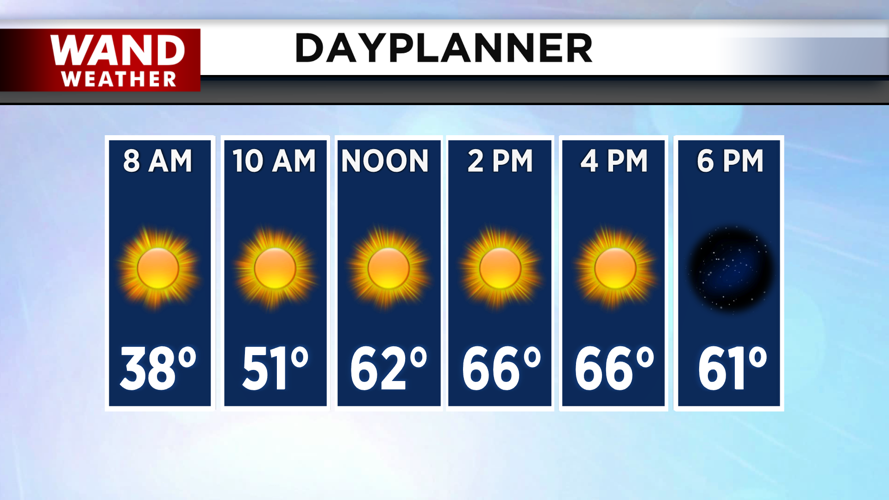


DECATUR, IL. (WAND) - Happy Friday! It will be a gorgeous end to the work week as sunny skies and warm temperatures take over today. It will be a chilly morning with temperatures in the upper 20s and low 30s. Temperatures will warm up very quickly as winds start gusting out of the southwest at around 25 to 30 mph. Temperatures will soar into the mid to upper 60s, and it will be the warmest day of the next 7 to 10 days.

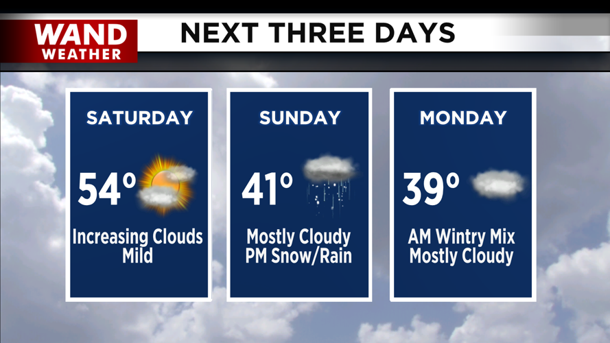
Temperatures will fall quickly tonight with the clear skies. Overnight lows will be around the low 30s. Saturday will be mild with sunny skies to start the day, but clouds will increase throughout the day. Temperatures will still warm into the 50s by the afternoon.
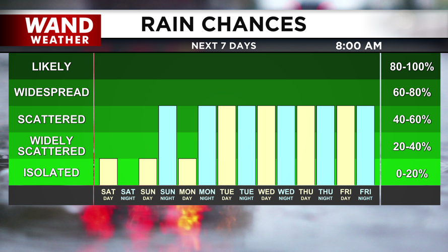
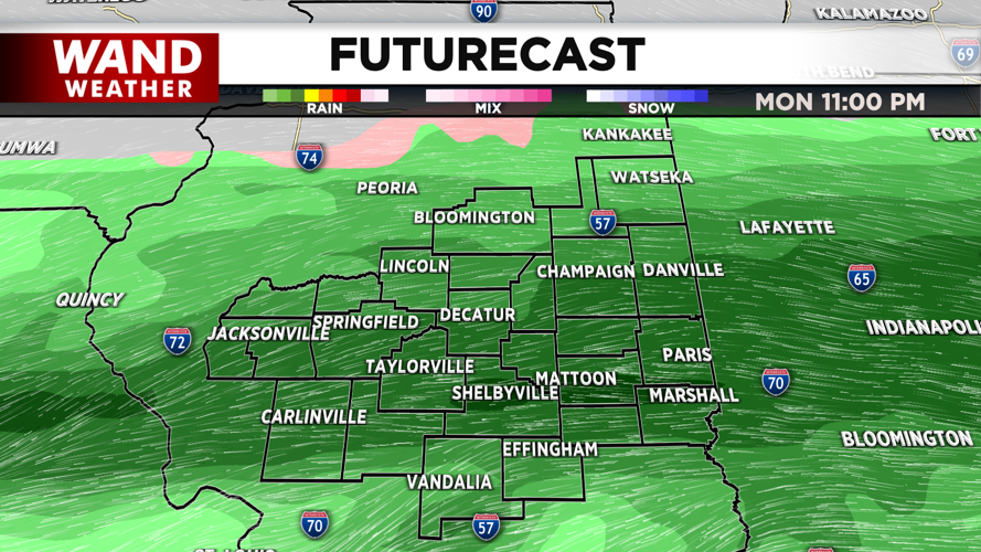
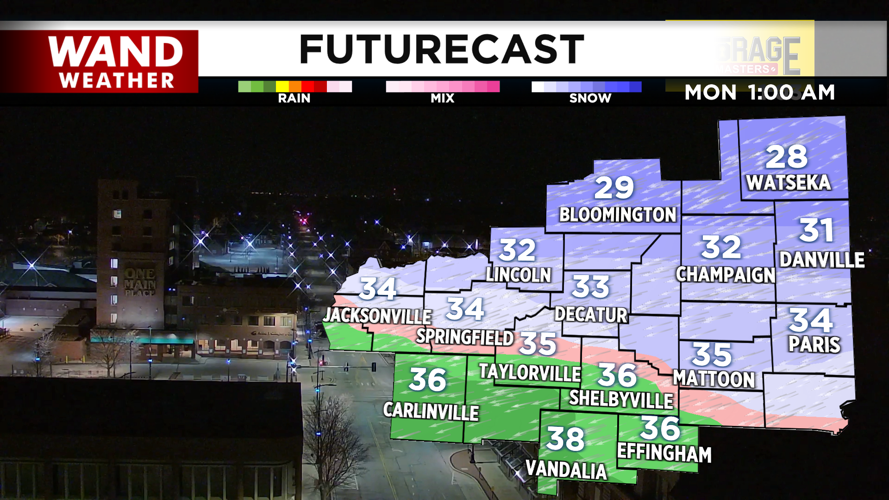
Sunday will begin a big shift in our weather pattern. Temperatures will be much cooler with highs in the 40s. A system will move in from the east by Sunday evening, and bring in some rain and snow chances. It looks like there will be a sharp cutoff between the rain and the snow. Snow chances are likely for areas along and north of I-72. Rain chances will be more likely in the south.


We expect the models to get a better handle on this system over the next few days, so watch the forecast closely this weekend. The biggest impact of this storm will be travel impacts for the Monday morning commute. Rain chances look likely for much of next week, so dust off the umbrella and the rain gear.

Have a great weekend!
Copyright 2026. WANDTV. All Rights Reserved.


