


DECATUR, IL. (WAND) - Happy Tuesday! After a hot weekend in the 80s, it was a cool start to the week in the 40s and low 50s. Temperatures cooled off quickly overnight, and temperatures are just below freezing in the upper 20s to start the day. There will be a mix of sun and clouds through the afternoon as temperatures warm up a little faster today. Highs this afternoon will push into the upper 50s, which is pretty seasonable for this time of year.
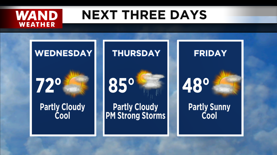
The warmer air will return on Wednesday afternoon. Temperatures will start in the low 40s, but warm quickly with a mix of sun and clouds. Highs will be back in the 70s for the afternoon. This warm-up will linger through the overnight hours, with temperatures only dropping into the upper 50s.
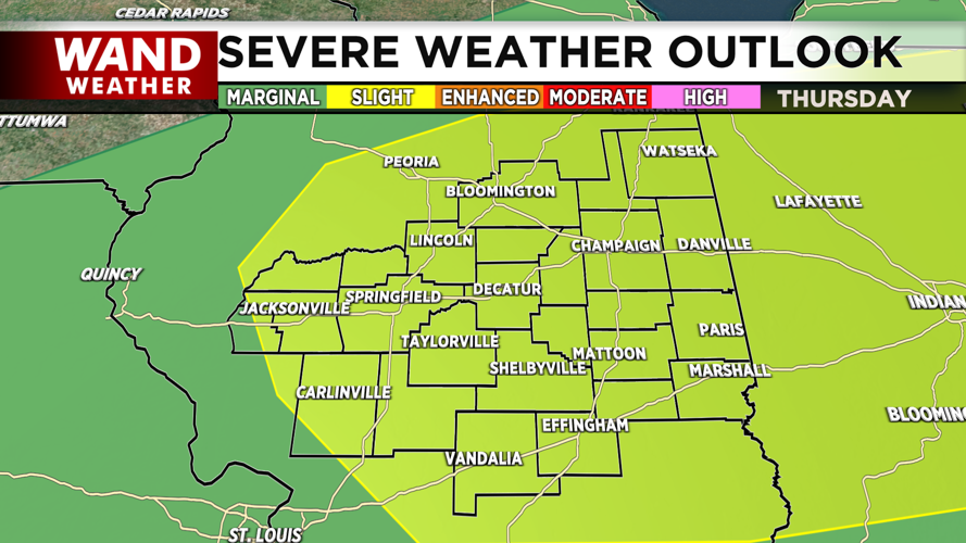
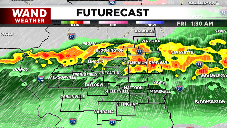
Thursday is the focus of our next weather maker. Temperatures will soar into the mid-80s. This should blow record highs for much of Central Illinois as a warm front lifts across the state. A strong cold front will push into the region through the afternoon and evening. This will bring chances for strong thunderstorms through the evening into Friday morning. The Storm Prediction Center has issued a slight (level 2 out of 5) risk for severe storms to develop. Wind and hail will be the biggest threats with these storms.
Be weather aware through early Friday morning. Temperatures will fall off a cliff behind this front. Expect overnight lows in the 30s, with high temperatures on Friday staying chilly in the 40s.
Copyright 2026. WANDTV. All Rights Reserved.


