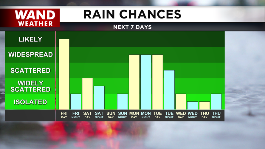
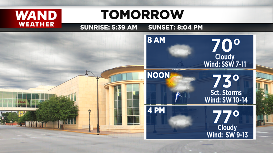
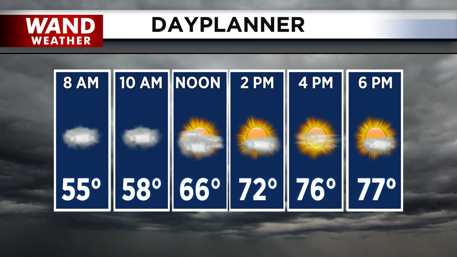
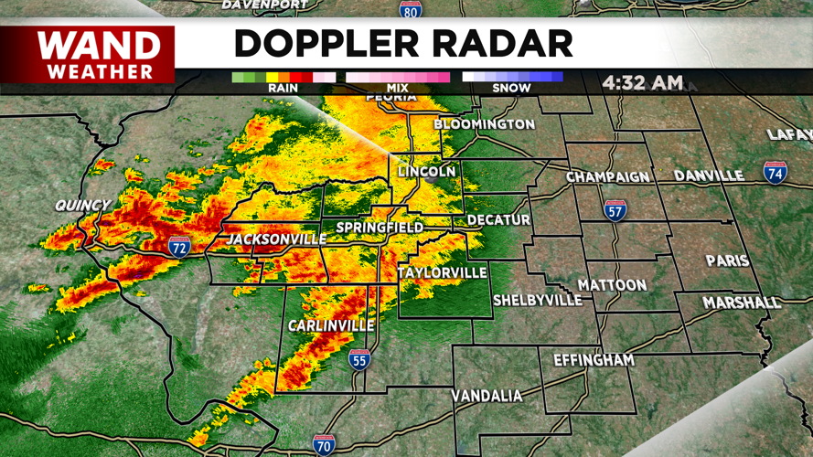


DECATUR, IL. (WAND) - Happy Friday! It will be an active morning with strong storms and some heavy rain rolling through the area. The severe weather risk is low, but there will be some gusty winds with some lightning through the early morning. Showers should clear out of the area by 9 or 10 am. Sunshine will move in for the afternoon. This will cause temperatures to soar into the upper 70s with muggy conditions.
Temperatures will drop into the low 60s overnight as clouds build back into the region. Storm chances will ramp up again overnight. These storms and showers will hang around Central Illinois through the afternoon. Don’t expect all day rain with periods of dry time in the mix. Storms will exit Saturday evening.
Sunday will be dry with a mix of sun and clouds. It will be very warm and humid with temperatures soaring into the upper 80s. Overnight lows will stay very warm in the upper 60s through Monday night. Storm chances move back in on Monday and Tuesday. Some severe weather risks will be associated with these storms. We will watch these closely over the next few days.
Cooler temperatures will return next week with seasonable highs in the low 70s. Have a great weekend!
Copyright 2026. WANDTV. All Rights Reserved.


