

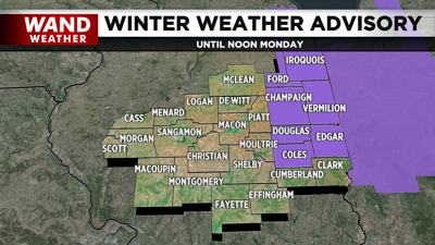
DECATUR, IL. (WAND) - Happy Monday! We are kicking off the work week with a taste of winter. Lake enhanced snow showers have developed behind our departing low early this morning. A Winter Weather Advisory has been issued for most areas along and east of I-57. It highlights how these areas could see accumulations from 1-3 inches with the northernmost counties Iroquois and Ford seeing up to 6.

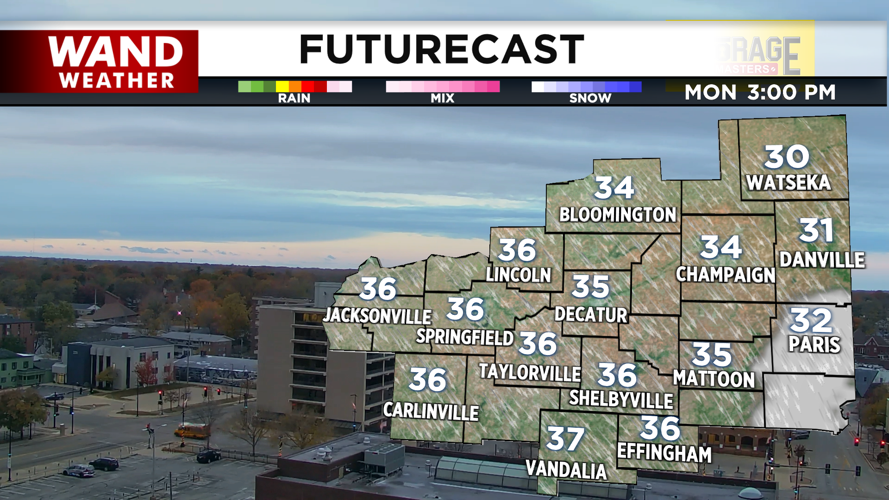
Snow showers will likely wrap up by 9 am for most, leaving us mainly sunny by the afternoon. However, the blustery and near freezing conditions will continue throughout the day. Highs will top off in the mid 30s.

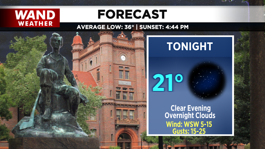
Tonight, clear skies will allow for overnight lows in the low 20s, but a warm front will bring more clouds by tomorrow morning. A gradual warming trend sets up for the rest of the week, and will leave us unseasonably warm by next weekend.
Copyright 2025. WANDTV. All Rights Reserved.


