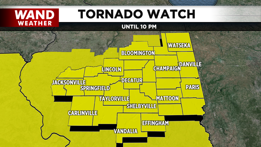


DECATUR, Ill. (WAND) - A new Tornado Watch has been issued for Central Illinois as a second round of severe weather beings to form.

Counties shaded in yellow are under a Tornado Watch until 10 p.m. CDT on Wednesday, June 17, 2026. (WAND Weather)
The watch is in effect for all of the WAND viewing area and is in place until 10 p.m. CDT.
The WAND Weather team has been tracking severe storms Wednesday. Forecasts have been calling for strong tornadoes, damaging winds, hail, wind, and lightning.
Power outages are likely in areas.
Wednesday morning storms produced some outages, but there were no major reports of damage.
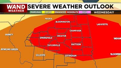
Most of the WAND viewing area is also under a Moderate Risk for severe weather. That's level 4 out of 5 that the National Weather Service uses to classify storms risks. Other areas are under an Enhanced Risk, which is a 3 out of 5.
Stay up-to-date with regular video forecasts, weather alerts, and a live radar in your neighborhood with the WAND Weather app. It's available for download in your phone's app store.
Copyright 2026. WANDTV. All Rights Reserved.


