


DECATUR, IL. (WAND) - Dangerous storms are expected to hit Central Illinois today. There will be two separate rounds of storms that could trigger severe thunderstorm and tornado warnings. Temperatures this morning are a little bit cooler in the 50s, but warmer air will move in quickly with very strong winds out of the southwest.
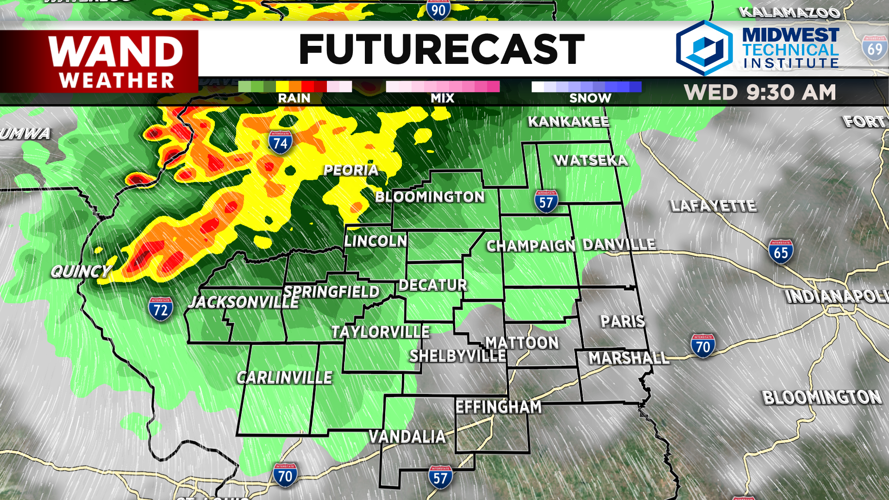
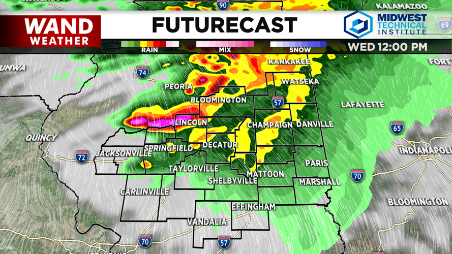
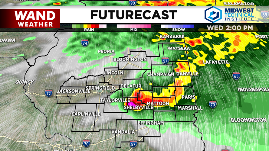
Temperatures will be in the 70s by 10 am, and that’s when the first round of storms is expected to move into areas north of I-72. These storms will sink south and east through the late morning into the early afternoon. Areas south of I-72 will see rain, but the bulk of the severe weather this morning will be further north. Wind and hail will be the primary threats with the morning storms.
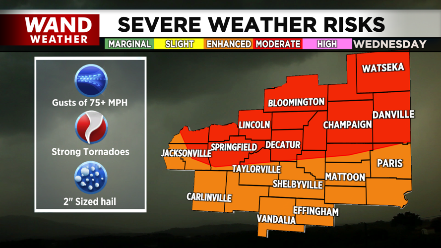
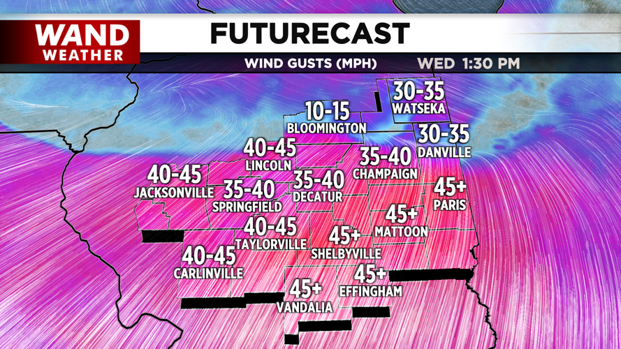
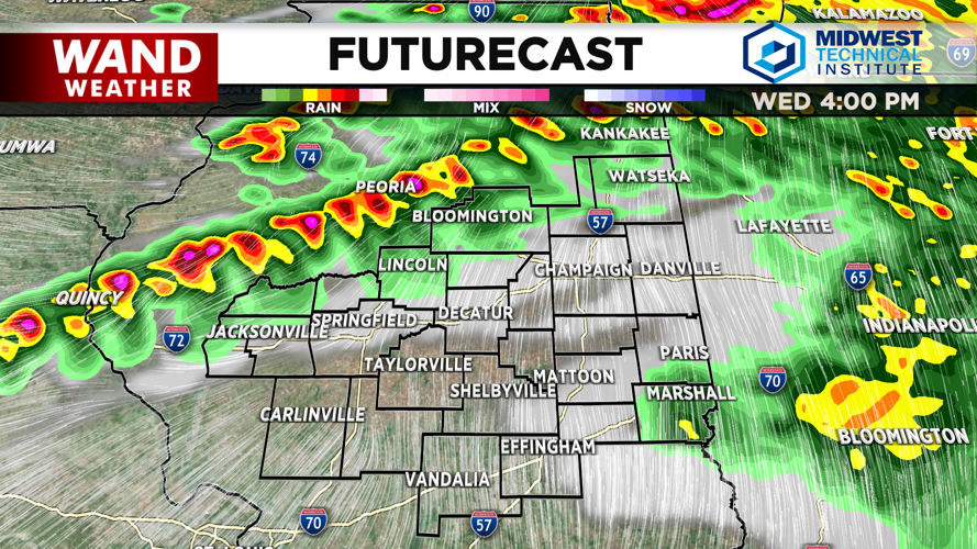
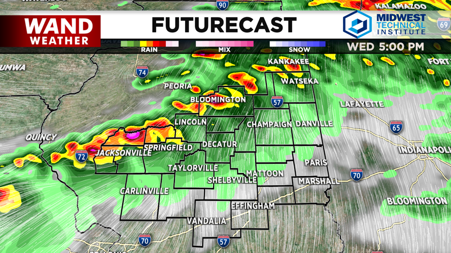
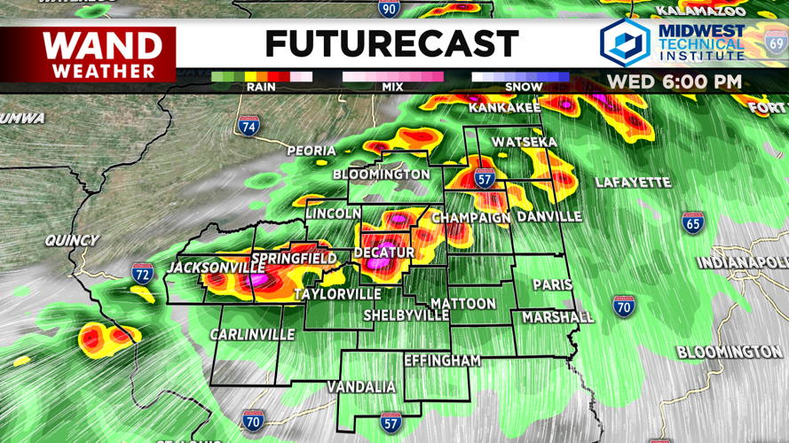
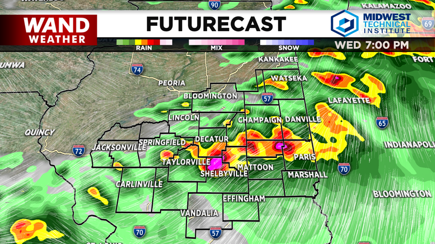
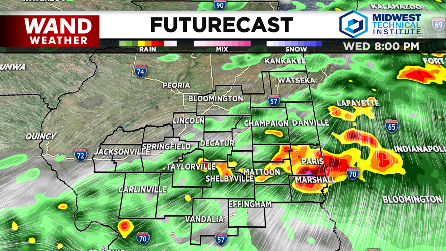
Showers should exit around 1 or 2 pm. Temperatures will soar behind the morning storms into the 80s. This will fuel the second round of storms that will move in this evening. Expect an organized line of storms to move into the area around 5 pm. All modes of severe weather will be possible with this setup, including some strong tornadoes. Wind gusts could hit 75 mph or higher in these storms. Power outage concerns will persist with these storms.
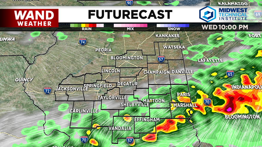
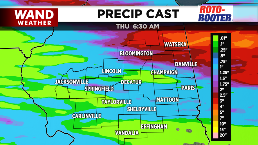
Thunderstorms should exit Central Illinois around 10 pm. Some flooding is possible overnight with the heavy rain. Temperatures will be much cooler on Thursday with a mix of sun and clouds. Friday looks great with sunshine returning.
Copyright 2026. WANDTV. All Rights Reserved.


