


DECATUR, Ill. (WAND) - Last year, after the middle of June, there were eight tornado days for the calendar year with a total of 44 tornadoes. This Wednesday will mark eight tornado days through the middle of June as well. Unfortunately, we've already had 50 tornadoes this year. This is all well above the average of 20 per year for central Illinois.
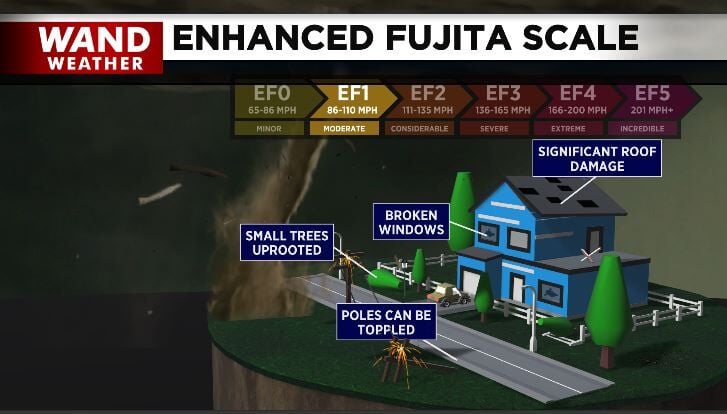
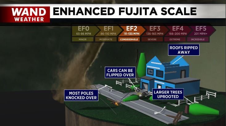
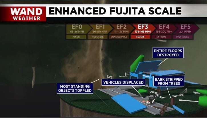
Wait. It gets worse. Like last week, these storms will move fast across the region. Unlike last week, the coverage area may increase as the tornadic threat will extend all the way past I-70 to the south. Out of the 12 confirmed tornadoes last week, 10 were EF-1 and two were EF-0. Take note of the graphics above and the intensity/damage associated with each from EF-1 to EF-3.
This Wednesday may feature stronger tornadoes, so make sure you know where you will be when severe weather strikes, and where the safest location will be for you. Always put as many walls between you and the outside as possible, along with being on the lowest level possible.
The initial batch of rain with embedded thunderstorms Wednesday morning will be primarily a wind/hail event. The second round of thunderstorms will become supercells, capable of spawning multiple intense tornadoes. This will develop first toward the northern part of McLean County to the Illinois River near 5 p.m., then progress southeastward. Storms will likely exit south of I-70 shortly at 10/11 p.m.
Stay safe and stay weather-aware.
Copyright 2026. WANDTV. All Rights Reserved.


