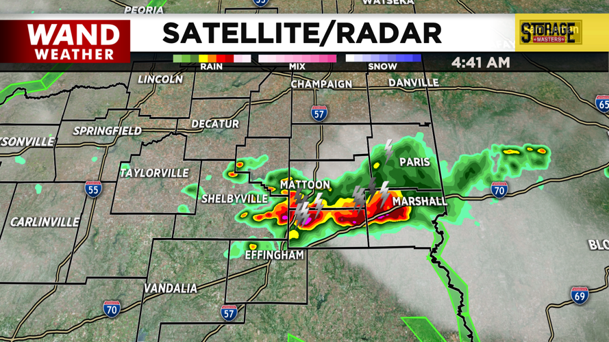


DECATUR, IL. (WAND) - Happy Thursday! The scattered storms from yesterday were on the strong side in a few spots. There could be a few more isolated storms throughout the day today, but most of the rain is going to hold off until the overnight hours. Expect mostly cloudy skies again for today with temperatures in the low 80s by the afternoon. Storm chances will ramp up through the night.
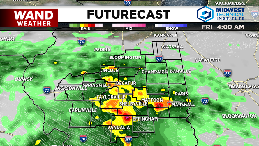
Around 3 or 4 am is when we expect heavier thunderstorms to move into Central Illinois on Friday morning. Friday will be an active day with a few rounds of strong storms. A flood watch is in effect for areas along and south of the I-72 corridor. 2 to 3 inches of rain can’t be ruled out, so high water issues will be the main concern with these storms.
The rain should exit Friday evening into the overnight hours. The weekend is looking mainly dry and hot. There could be a few isolated showers on Saturday and Sunday, but most of the area will be dry. Humidity will ramp up on Sunday and hang around for most of next week. Expect feels-like temperatures to hit the triple digits by Sunday afternoon. The oppressive heat will hang around through at least the first few days of July.
Copyright 2026. WANDTV. All Rights Reserved.


