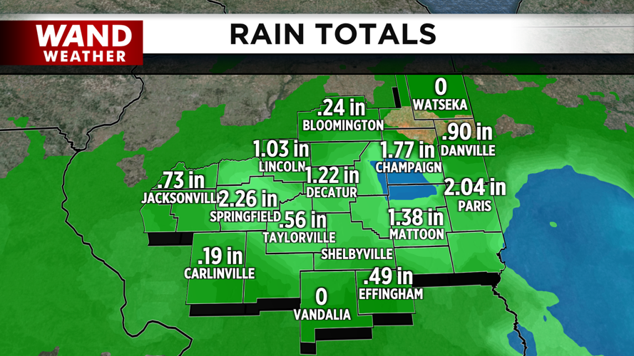


DECATUR, IL. (WAND) - The rainfall on Tuesday was extremely beneficial for a wide swath of Central Illinois. Most areas along I-72 saw close to 2 inches of rain. Some areas reported 3 inches of rain due to the thunderstorms that rolled through Tuesday afternoon. Officially, Decatur was just shy of 2 inches, but the rainfall this morning bumped up our totals over 2 inches for the 24-hour period from when the rain began.
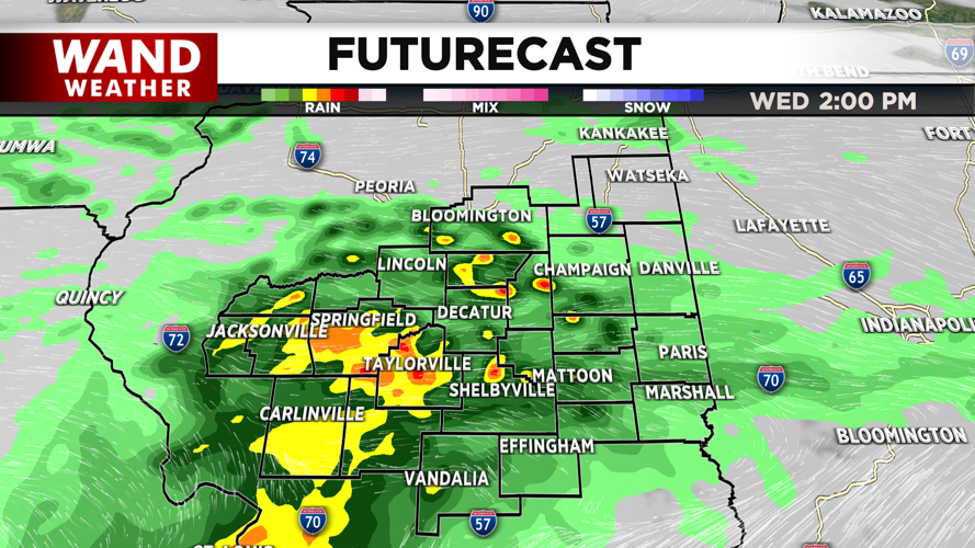
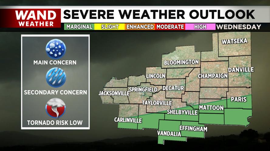
Another round of showers and storms will move through the area later this afternoon and evening. A round of showers will lift northwards throughout the afternoon, and this has the potential to hit severe limits. The area of concern will be along the I-70 corridor. Be weather aware through the early evening. Hail and strong wind gusts will be the primary concern, but isolated tornadoes cannot be ruled out.
The bulk of the storms will exit before 8 pm, and then another round of storms will be possible overnight tonight into early Thursday morning. The next severe threat won’t arrive until Friday evening. Stay weather aware, and download the WAND weather app for the latest forecasts.
Copyright 2026. WANDTV. All Rights Reserved.


