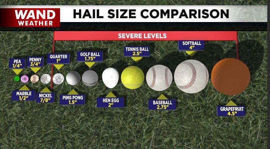


DECATUR, Ill. (WAND) - Our part of central Illinois escaped the worst of the storms earlier Tuesday. The same CANNOT be said for Tuesday night. Reports of hail with a five-inch diameter, larger than a grapefruit, came in from the Kankakee area. If this is verified, it will set a new Illinois state record for the largest piece of hail. That speaks volumes to the intensity of this storm system.
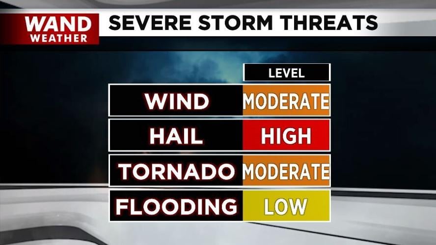
Unfortunately, all modes of severe weather are on the table tonight, arriving from Missouri. This includes large, destructive hail that can severely damage roofs and siding, along with cars. If you have a garage or carport, use it! Strong tornadoes with damaging winds well in excess of 100 mph, if not over 120 mph, can also occur. Obviously, not everyone will experience severe weather, but many can. Since these storms are arriving late, you will need a way to receive the latest warnings and know how to get into your safe place on a moment's notice.
Stay safe and stay weather-aware.
Copyright 2026. WANDTV. All Rights Reserved.


