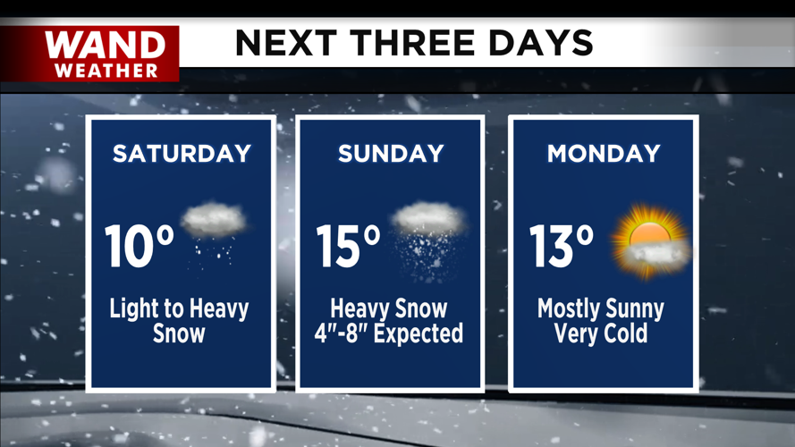
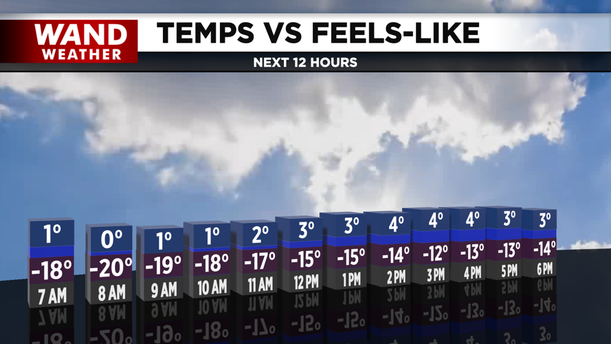


DECATUR, IL. (WAND) - A dangerously cold Friday is on tap today. A cold weather advisory is in place until noon Saturday. Actual temperatures will be in the low single digits, but wind chills will be significantly colder than that in the negative 20 degree range. The clouds will clear briefly this afternoon, but overcast skies will return overnight into Saturday morning.
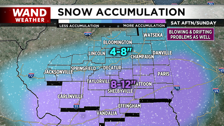
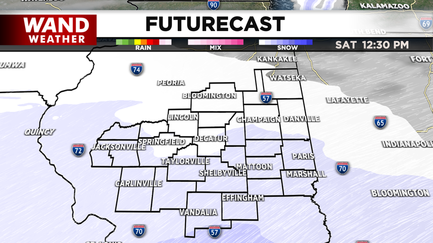
The temperatures will stay below 0 with wind chills through the weekend, but our attention will turn to the heavy winter storms moving across the United States. Saturday will start off cold and quiet. Light snowfall will begin to fall across Illinois around noon. The snow will last for a few hours until about 4 or 5 in the evening. Accumulation through Saturday afternoon looks light with around an inch or two for areas north of I-70.

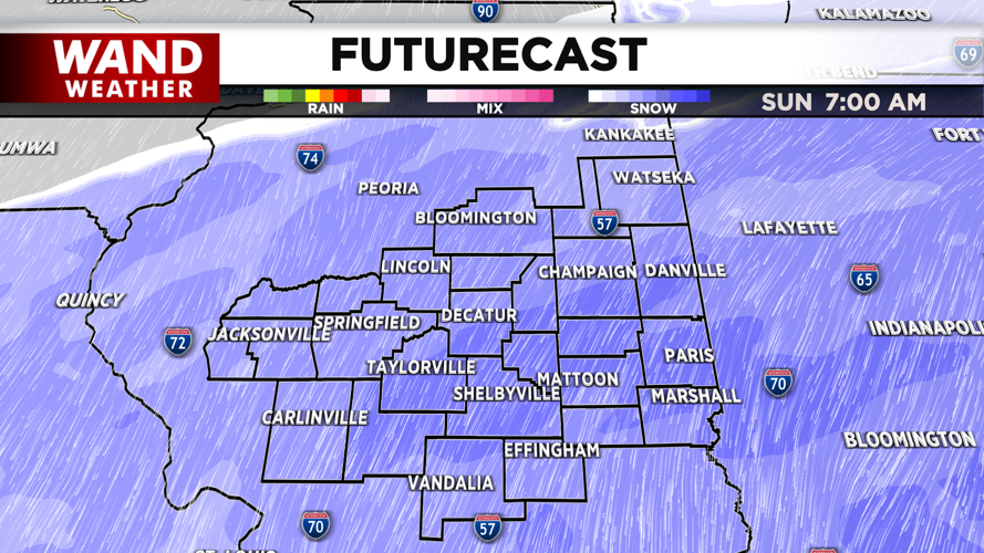
The second wave of snow will be much heavier. Snow will resume around 11 pm Saturday evening. Snow will pick up through the morning and be heavy through the early afternoon. Snow should exit by the evening. Totals between I-70 and I-72 will range from 6-8 inches. Areas south of I-70 will be much higher, with 10 inches or more expected.


Cold temperatures will hang around next week. Snow chances look slim after the weekend, but another light snow could move in next week.

Stay safe and warm!
Copyright 2026. WANDTV. All Rights Reserved.


