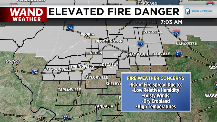


DECATUR, IL. (WAND) - Another beautiful forecast is in store for our start to the week, but another concern arises this afternoon: elevated fire weather.

Our next weather maker is a cold front that is gradually sweeping through the Rockies and the northern Great Plains. As it approaches, it brings us gusty winds up to 30 mph. Between the existing dry cropland due to the drought, and the dry air aloft with relative humidity dropping to 25-35% this afternoon, gusty winds will only make it much more difficult to contain a fire if one were to break out. A Special Weather Statement is in place along and north of I-72 regarding the risk of fire spread until 7pm.
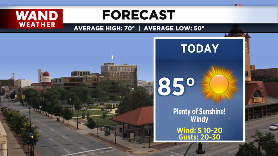
Other than fire weather concerns, our forecast looks sunny and bright today. Temperatures will be in the mid 80s and breezy conditions should make for comfortable outdoor conditions.

Skies will be clear and temperatures will be cool in the low 60’s tonight. Thanks to clear skies tonight, viewing conditions for the full Harvest/Hunter’s Supermoon will be perfect! Even though peak illumination will be tomorrow night, rain and clouds will be moving in with a cold front, blocking out the view.

Copyright 2025. WANDTV. All Rights Reserved.


