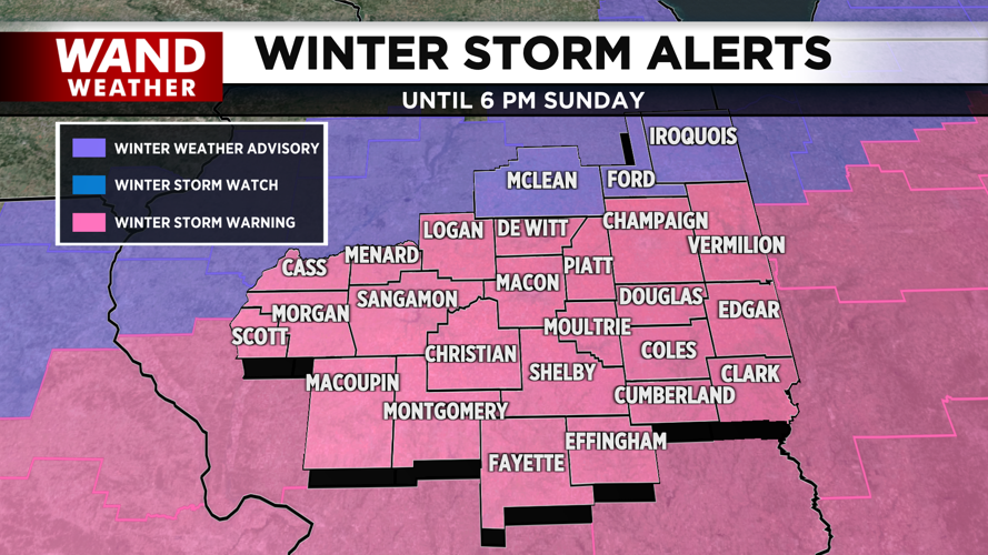


DECATUR, IL. (WAND) - The winter storm continues this morning with steady snowfall across central Illinois.

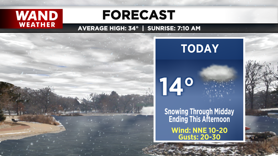
Steady snowfall will continue through the early morning, then become scattered by midday. These showers will gradually taper off by the early afternoon from west to east. We may even see a few additional isolated lake effect showers for areas farthest northeast. This will drop an additional 1-4 inches of snow.

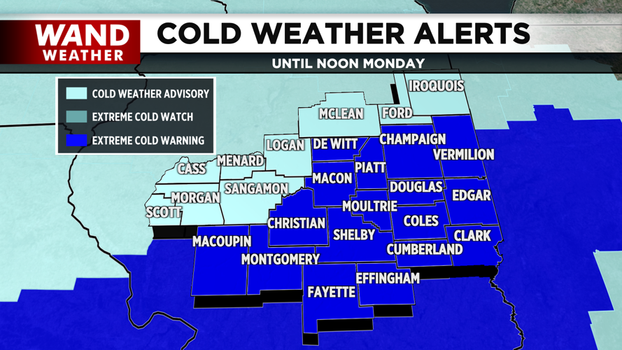
Skies clear tonight, allowing temperatures to drop into the negatives. Gusty winds will not only pose the concern of blowing snow after the snow ends, but also dangerously cold wind chills in the negative 20s by tomorrow morning. An Extreme Cold Warning is in place from this evening through midday tomorrow.
This round of frigid air in the negatives continues as we head throughout the workweek, and several mornings with wind chills in the negatives will be in store.
Copyright 2026. WANDTV. All Rights Reserved.


