

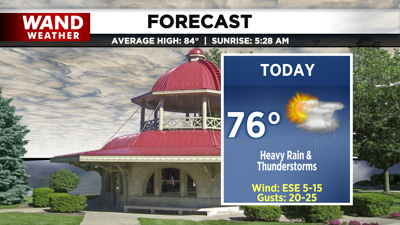
DECATUR, IL. (WAND) - Happy Father’s Day and first day of Summer! We’re kicking off the official start of summer with heavy rain and thunderstorms.
Our next weather maker arrives today- a low-pressure system that will track straight through central Illinois. This will allow for heavy rain to lift in by midday and strong thunderstorms by the afternoon.

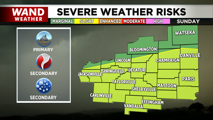
Even behind our warm front, cloudy skies and rain may limit temperatures this afternoon to the mid to low 70s. While this will limit the severe weather potential for the northern half of the region, the placement of the low, the possibility of dry air briefly moving in this afternoon, and even a marginal amount of daytime heating and instability may allow for thunderstorms to go severe south of I-72. This would be a concern mainly


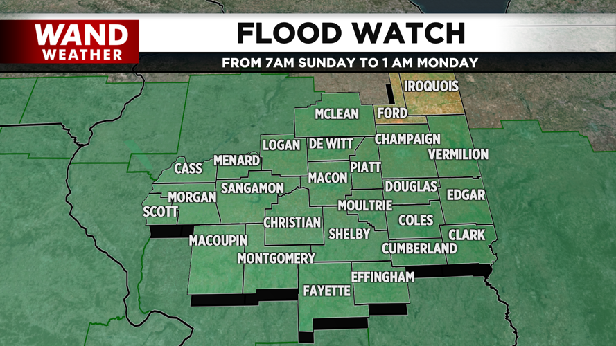
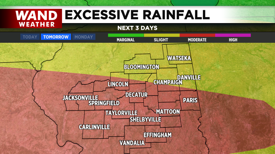
Our highest weather impact, however, will likely be excessive rainfall concerns. A Flood Watch is in place across most of the region this morning, highlighting concerns of flash flooding wherever the strongest thunderstorms set up.
As the cold front sweeps through tonight, showers will gradually taper off late overnight.
Copyright 2026. WANDTV. All Rights Reserved.


