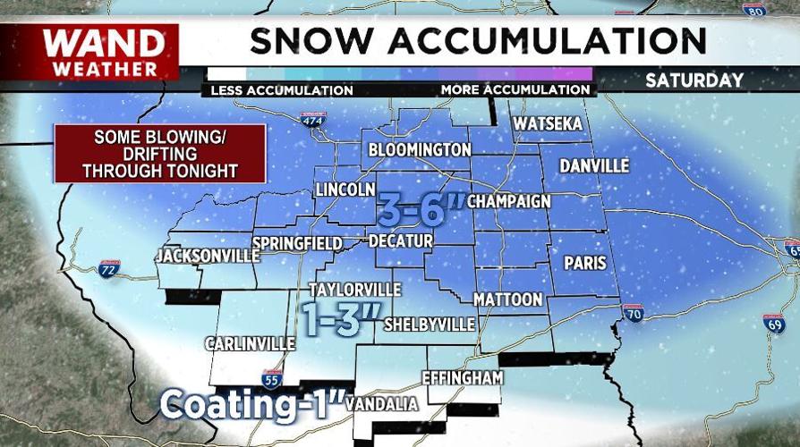

DECATUR, Ill. (WAND) - Another blast of accumulating snow for central Illinois on Saturday.
Much like its predecessor, this event will be a fast-moving storm that will wind down later Saturday afternoon from west to east.

Before it does, accumulations will peak near an inch per hour!
The main difference between this storm and Thursday night's feature is the snow composition. Saturday's storm will be a lot lighter and fluffier, powdery, if you will.
It's easy to shovel, but for some of us, it may take a couple outings. The reason: blowing and drifting. The wind won't be terribly strong Saturday afternoon and night, but even 10-15 mph will be enough to blow the powdery snow around.

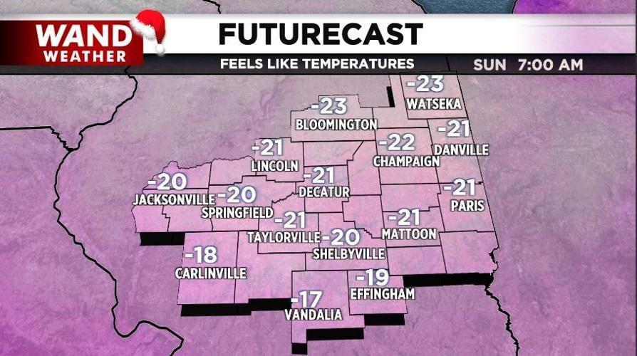
If the snow wasn't enough, air that originated over Siberia will drop in Saturday night and Sunday. Feels like temperatures will become dangerously low, bottoming out near -25 in spots!
Copyright 2025. WANDTV. All Rights Reserved.


