
DECATUR, Ill. (WAND) - I once had a professor at Penn State ask his class of aspiring meteorologists who had a calendar hanging on their wall at home/dorm room? This was before the age of cell phones, so of course, most of us did. His response was, why? As meteorologists, we do not use them. We look at the origin of the air mass. And, that is exactly what we are doing again today and the next day, and the day after that, etc., etc.
Weather / Storm Coverage
Weather | Radar | Weather-Blog | SendIt
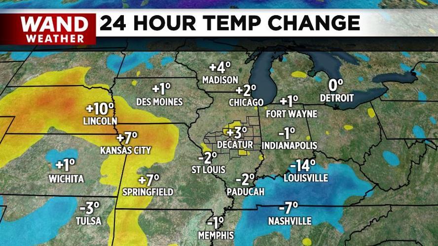
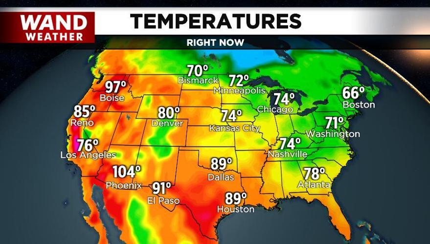
A cold front is headed to our residence, but in advance of it, there is more warmth to the west that has to initially arrive here. You can see that on the 24-hour change graphic as well as the orange-shaded area on the temperature map. That orange area is indicative of 80-degree air. On the flip side, the blue-shaded area to our north (Canada) represents the 50s. We will have it all as the origin of our air changes over the next day or two, as 80+ degree air will give way to rain-cooled air, which will then give way to 70s by day and even colder weather at night.
Meteorological fall is here, and it is off to a wild start in the temp department.
Stay weather aware and stay sweaty.
Copyright 2025. WANDTV. All Rights Reserved.


