

DECATUR, IL. (WAND) - Central Illinois is in for a dangerous stretch of weather through early next week, with dangerously hot conditions and multiple rounds of thunderstorms threatening the region.
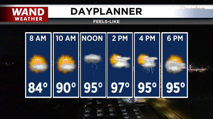
TODAY: SCATTERED STORMS IN OPPRESSIVE HEAT
Expect another sweltering day with heat indices climbing into the upper 90s to around 100 degrees this afternoon. Scattered thunderstorms will be possible mainly during the afternoon and early evening hours, with a 30-50% coverage area. While most storms should be brief, locally heavy rain is the primary concern. A few stronger cells could also produce gusty winds, so stay alert if storms develop in your area.
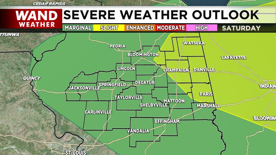
SATURDAY: STRONG TO SEVERE STORM THREAT
Saturday will start hot and humid before a cold front pushes into Illinois late in the afternoon and evening. This is when the weather becomes more dangerous. Strong to severe thunderstorms are possible, with damaging winds as the primary threat. Locally heavy rainfall is also possible with any storms that develop. Heat indices will reach 100-105 degrees Saturday afternoon before storms move in.
SUNDAY: A BRIEF BREAK
Sunday offers some relief with calmer conditions and slightly cooler temperatures in the mid-80s. This will be the most pleasant day of the extended forecast.
EARLY NEXT WEEK: MORE STORMS AND COOLER AIR
Another round of storms is possible Monday night into Tuesday morning as a stronger cold front moves through the region. Once this system passes, much cooler and less humid air will move in. High temperatures will drop back to the low 80s by next week, providing a welcome break from the oppressive heat.
Copyright 2026. WANDTV. All Rights Reserved.


