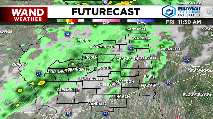
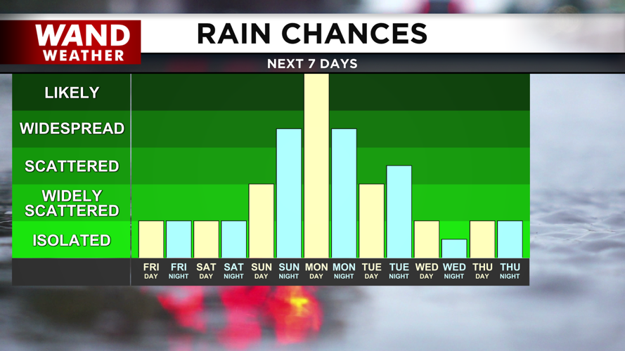


DECATUR, IL. (WAND) - Happy Friday! It has been a warm but dry week, but a change in our weather pattern will bring in much more moisture for the weekend. Strong winds today will gust out of the southwest at 25 to 30 mph. This will drive in much warmer temperatures over the next few days. Rain chances will arrive around late morning. This first round of showers will be very scattered and light.
Temperatures will continue to climb into the mid-80s with a mix of clouds and sunshine. Stronger storm chances will move in for the late afternoon and evening. Some of these scattered storms will be strong to severe. The best chance for storms to hit severe limits will be north of I-72. Some hail and strong wind gusts will be the biggest threat. Storms will exit overnight.
Scattered showers and storms will linger through the weekend. Temperatures will be in the upper 80s on Saturday and Sunday, but the heat index will be higher in the low to mid-90s. Storms will become more widespread overnight Sunday into Monday. Monday looks like a washout day with rain through the afternoon. Temperatures will be much hotter in the 90s for the back half of next week.
Copyright 2026. WANDTV. All Rights Reserved.


