


DECATUR, Ill. (WAND) - After extensive surveying and research, the National Weather Service confirms 19 tornadoes in our are (33 across all of central Illinois) from last Friday. And, the season is far from over.
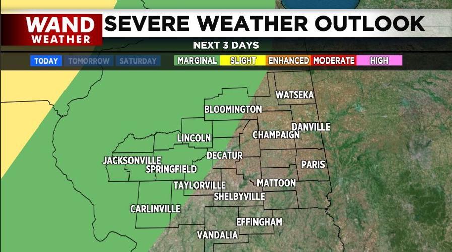
A cold front crossing the Plains into the Midwest overnight and Friday will weaken somewhat on approach. So, the severe weather threat is minimal and limited to western locales during the wee hours of Friday morning. Nothing tornadic here, unlike our neighbors to the west. Wind gusts in some of the storms overnight may peak 50-60 mph.
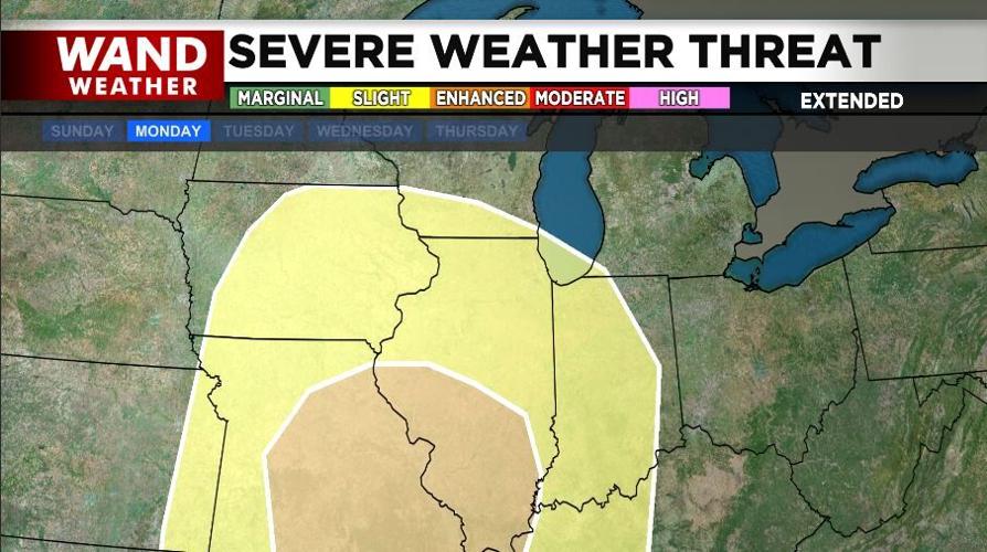
A more powerful storm, currently residing over the Pacific ocean, arrives early next week. Unfortunately, all modes of severe weather are possible Monday. A warm front is forecast to cross the area that day. Any morning precipitation in advance of the warm front will be minimal. The atmosphere is expected to destabilize rapidly post-warm front, leading to that next round of severe storms.
There is plenty of time to make any preparations. There's also a wonderful weekend of weather sandwiched in-between these two events. So, stay safe, but also enjoy the great outdoors!
Stay sweaty and stay weather-aware.
Copyright 2026. WANDTV. All Rights Reserved.


