
DECATUR, Ill. (WAND) - This holiday season has been mired with late night/early morning fog. Tonight will be no exception. The inversion which has been touted for days continues to hold its ground across the state.
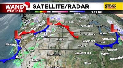
There is a light at the end of this cloudy/foggy tunnel. It's a cold front with associated low pressure along the West Coast. Said front will arrive later this weekend with showers and thunderstorms. While rain is needed to help ease the throttle on our drought, severe weather is not. The fast-moving nature of these storms likely won't allow for flooding downpours, but other modes of severe weather, albeit isolated, cannot be ruled out.
An abrupt change to winter weather will return behind this weekend's cold front. It will occur so fast that a flash freeze is possible despite gusty winds Sunday night. A near 50 degree drop in temperature will occur from Sunday to Sunday night! Some locales will have a 20+ degree drop in temperature over a couple hours.
Stay safe and stay weather-aware.
Copyright 2025. WANDTV. All Rights Reserved.


