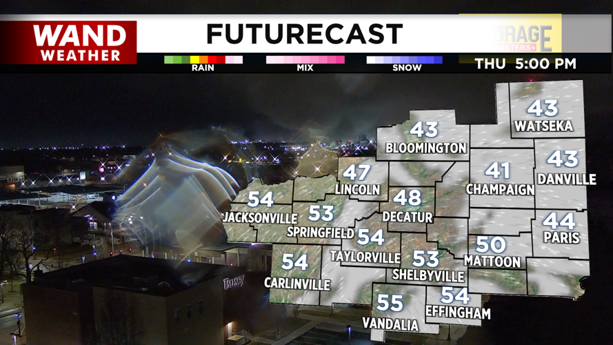
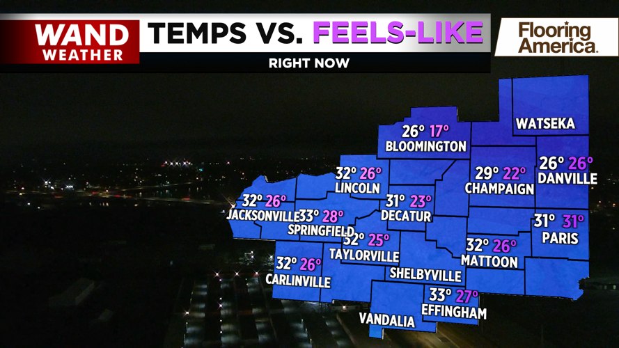

DECATUR, IL. (WAND) - Happy Thursday! Rain has transitioned to a wintry mix in parts of East Central Illinois this morning. Some slick spots will be possible for the early morning drive, but road conditions will improve quickly as temperatures warm up above freezing. It will be a cloudy first half of the day on Thursday, but sunshine is expected to break through the clouds late this afternoon.

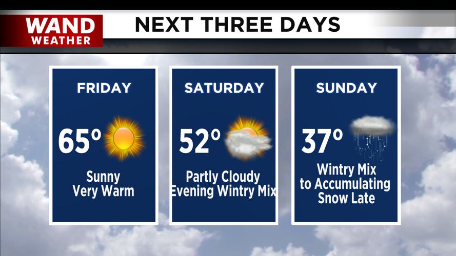
Friday should be a beautiful day to be outside. Temperatures will start cool in the low 30s, but sunny skies and winds out of the south will bring in much warmer air. Highs will top off in the mid to upper 60s.

The weekend will kick off an unsettled weather pattern. Saturday will be mild and mostly quiet as high temperatures will again be above average in the 50s. Rain chances will return Saturday evening. This could transition to a mix of some snow and sleet for early Sunday morning, but totals look very low.

Snow chances return Sunday afternoon. This could be a significant snow event for most of Central Illinois, but it’s too early to tell how much snow we could get. Stay tuned for the latest forecasts for more information on the weekend snow numbers.
Copyright 2026. WANDTV. All Rights Reserved.


