
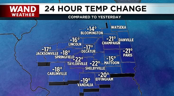
Saturday morning started off a bit cooler than Friday did which signals a pattern shift coming our way this weekend. The map below shows temperatures were about 20º colder across our area Saturday morning than they were Friday morning.
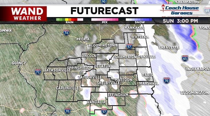
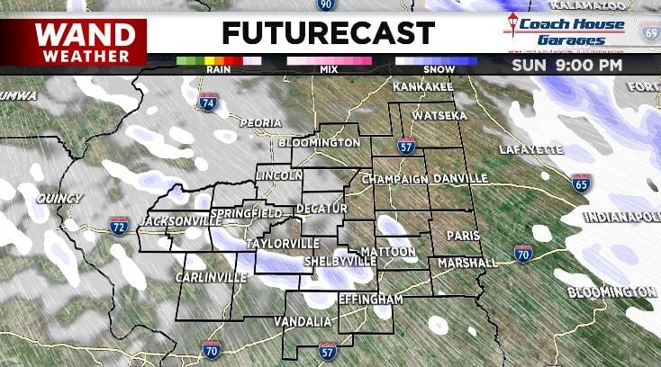
That cold air continues to flow into our region this weekend and means that what starts as light rain Saturday afternoon will transition to snow showers by Sunday morning. Those snow showers will continue off and on through Sunday, enhanced by northerly flow off Lake Michigan.
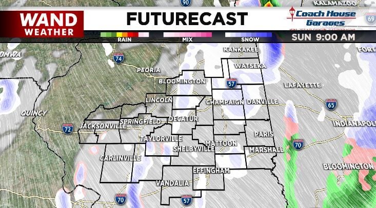
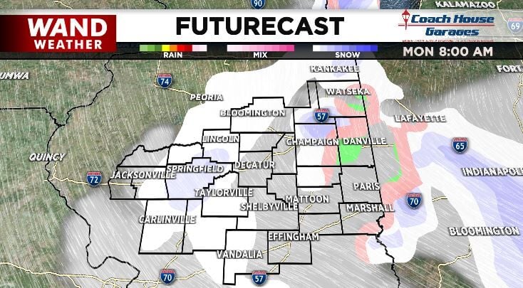
We won't talk about accumulation in this post because the ground is too warm for the snow to stick and stack up. You will see snowflakes flying in the air and may even get some to stick to your deck or car, but it won't accumulate.
What you don't see in these maps is that the wind will also pick up in the wake of this weather system. The wind will blow consistently to 20 mph Sunday through Wednesday with gusts up to 30-35 mph possible. That will add a wind chill factor to some already cold days.
Monday a few flurries will still be possible, especially early in the day. Monday will also be the coldest day this week, so dress in layers to protect yourself from the cold and the wind.


