(WAND) - Our week started off cool Monday, but conditions will warm over the next few days.
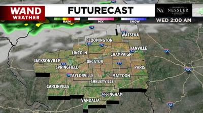
A frontal boundary draped across northern Illinois into tonight will bring a chance of showers and thunderstorms to our northern hometowns this afternoon into tonight.
The rest of central Illinois will be dry with a sun and cloud mix today and highs well into the 70s.
Mostly sunny skies and warm temperatures are forecast Wednesday and Thursday with highs around 80°.
Showers and storms are likely as we head into Thursday night and Friday.
At this point, the weekend looks mostly dry until showers arrive Sunday night.
Meteorologist Anthony Peoples
Copyright 2025 WAND TV. All rights reserved.


