

DECATUR, IL. (WAND) - We’re preparing for a winter storm this weekend, but we’re currently dealing with extreme cold. Details below:

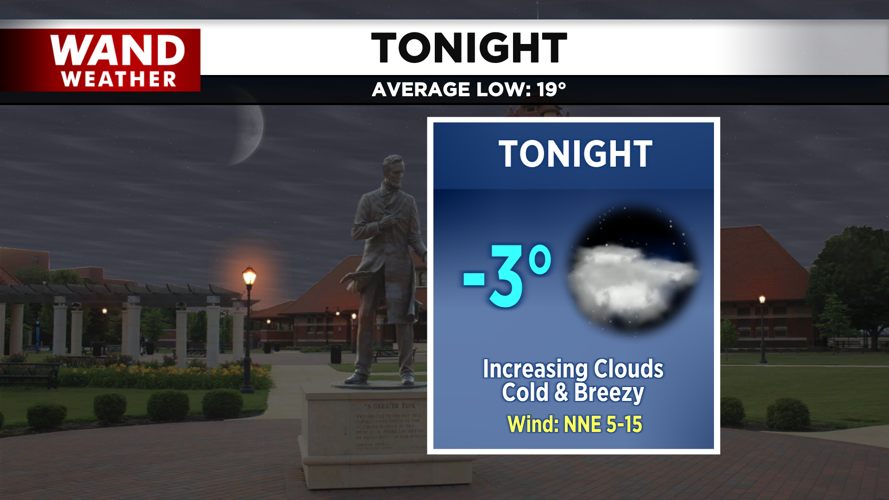
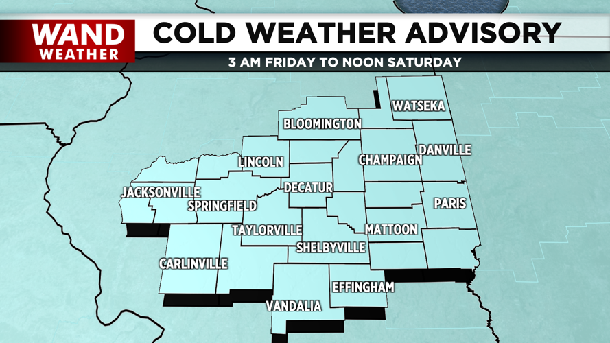
Overnight lows tonight will be in the negatives, and breezy conditions will leave us feeling like negative teens. Because of this, our Cold Weather Advisory will persist through midday tomorrow.

Tomorrow, we start the day frigid but quiet. We may see an early isolated snow shower, but the more widely scattered showers will move in by tomorrow afternoon. This will likely bring up to 2 inches of snow by tomorrow evening.
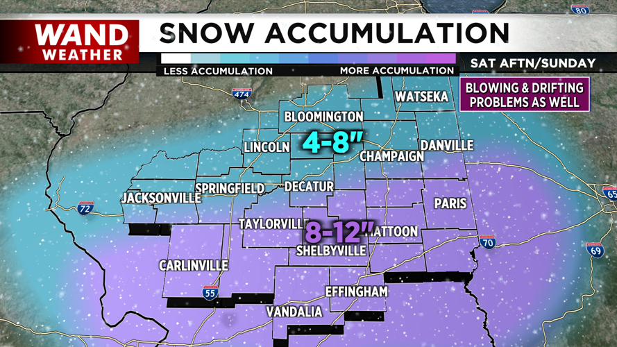
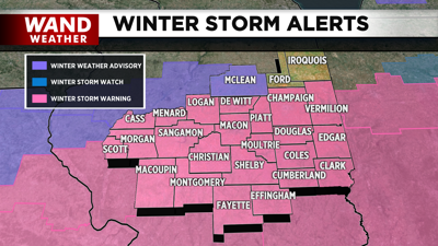
A second round of widespread snow will likely arrive overnight Saturday into early Sunday morning, and taper off in the afternoon. This will likely bring totals to 8-12 inches along the I-70 corridor, and 4-8 inches along the I-72. Gusty winds and powdery snow will also bring concerns of drifting and blowing snow.

Extremely cold conditions will continue into the work week, with several mornings in the negatives in store.
Copyright 2026. WANDTV. All Rights Reserved.


