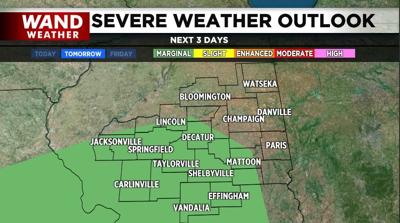

DECATUR, Ill. (WAND) - Nothing is set in stone for severe weather come late Thursday or Thursday evening. However, anytime we have a major push of warm, humid air into the region at this time of year, you have to ask yourself, can there be severe storms?
First and foremost, this is not the same time of event as the Dec. 28 tornado outbreak. That said, there is tremendous wind shear available in this setup. That is a shift in wind speed with height. More of a concern is the pocket of drier air sitting above our heads at the onset of Thursday afternoon. As rain falls into this drier pocket, it will evaporate. Evaporation is a cooling process. Cool air is denser than warm air, so a downward transport of wind is possible near and in any thunderstorm during this time frame. The evaporation will enhance that downward transport, perhaps leading to damaging wind gusts in a few areas.
The best upper-level support for severe weather may swing and miss to our south, but it will certainly be worth your time to stay abreast of Thursday's changing weather.
As always, stay up-to-date with the weather by downloading the WAND weather app, which has futurecast Doppler radar as well as a location tracker to give you the watches and warnings for your location.
Copyright 2026. WANDTV. All Rights Reserved.


