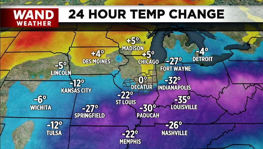


DECATUR, Ill. (WAND) - It was quite the weather change over the past 24 to 36 hours. And, we're not done.
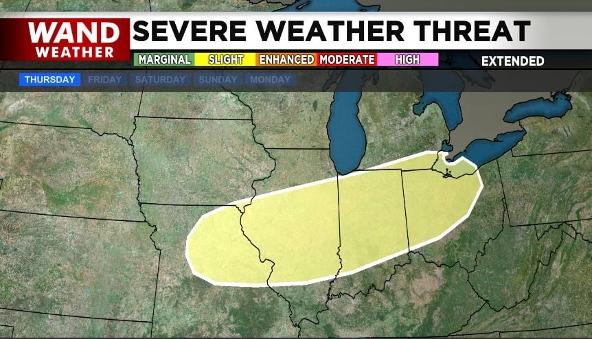
Thickening clouds will help prevent frost from forming overnight, but that doesn't take away sub-freezing temperatures. After the cold start Tuesday, warmer weather will begin to take over again. However, warm and somewhat humid weather this time of year can easily lead to severe weather.
For now, the next cold front that will usher in a big temperature swing is due Thursday night. Ahead of said front, 80+ degrees will be the order of the day. The big question, or questions, is if and when the cap on the atmosphere can break? Also, does a more stable pocket of air stay put at the ground, allowing more unstable air aloft? If so, the prospect of a tornado would be greatly diminished. Unfortunately, that is not etched in stone. Regardless, even unstable air aloft can lead to severe thunderstorms with wind and hail damage.
It's best to stay safe and stay weather-aware over the coming days.
Copyright 2026. WANDTV. All Rights Reserved.


