
(WAND) - The stretch of dry weather is expected to continue across Central Illinois through the remainder of the work week.
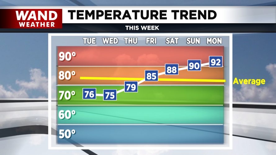
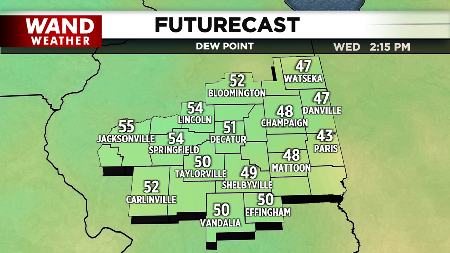
Temperatures through Friday morning will be below average; with highs in the 70s and lows in the 50s. The peak of the cool air will be today and Wednesday; with overnight lows for tonight & Wednesday night dipping for some in the 40s. Skies through Thursday will be mostly sunny to sunny, while enjoying pleasant dew points in the 50s.

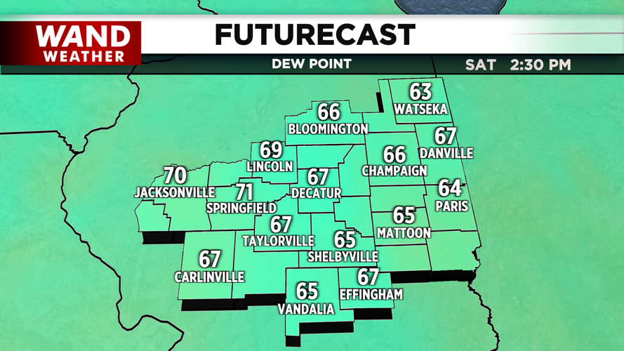
Friday will serve as a transition day, as the humidity and warmth begin to increase; where dew points return into the low 60s & highs into the mid 80s. A stray shower or storm is also possible on Friday & Saturday night. The weekend will consist of a mix of sun and clouds; while dew points bounce back to uncomfortably humid near 70°. Highs will be in the upper 80s on Saturday, while hitting 90° by Sunday. The warmth & humidity continue to build more into Monday, as temperatures surge into the low 90s.

Meteorologist Ulises Garcia
Copyright 2024 WAND TV. All rights reserved.


