
(WAND WEATHER)- Central Illinois will see two rounds of snow through Thursday night.
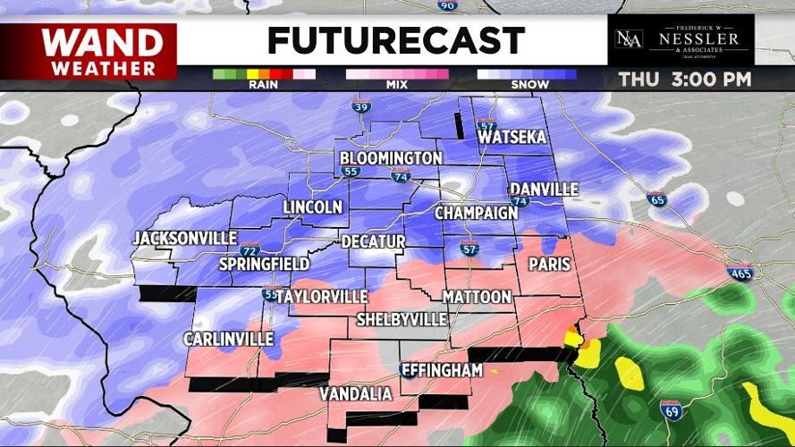
Light snow falling this morning will end before another heavier round of snow moves out of Missouri into the area later this morning.
As the day goes on, that snow will advance northeast across all of Central Illinois and could mix with freezing rain and sleet.
The system moves out early tonight and the snow will end as flurries.

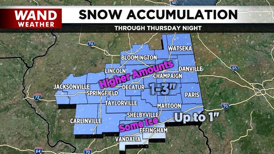
Accumulations will generally be in the 1"-3" range with the heavier totals across the north. Across the south, accumulations will be closer to one inch, but there'll be a little bit more of a glaze of ice there.
A warm-up kicks in this weekend with more sunshine. Highs will be in the 30s Saturday and the 40s Sunday.
Meteorologist Anthony Peoples
Copyright 2022. WANDTV. All Rights Reserved.


