
Central Illinois is gearing up for an extended period of heavy snow and blowing snow. Significant icing is also possible for our southern counties.
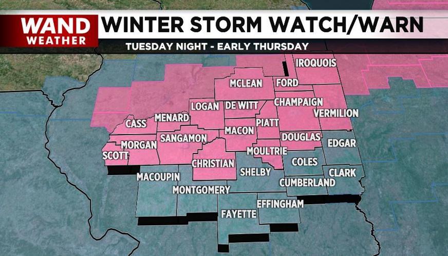
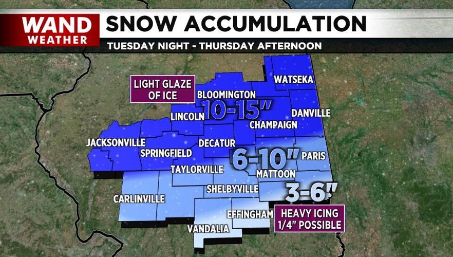
A winter storm warning now covers the counties basically along and north of Interstate 72 from Tuesday evening through Thursday evening. This area is likely to see incredible snowfall totals of 10-15 inches! This includes Decatur, Champaign, Springfield, Bloomington, Lincoln and Danville.
To the south of this line, a winter storm watch remains in effect for snow accumulations of 6-10 inches.
A light glaze of ice is also possible Tuesday night into early Wednesday in these areas.

Across our southern hometowns, we'll see a heavy coating of freezing rain (one-quarter inch or more) before it changes to snow late Wednesday night and Thursday. At this point, 3-6 inches will fall.
Rain will expand across central Illinois Tuesday, becoming heavier in the afternoon and evening. As a cold front passes by and temperatures fall, the rain will transition to freezing rain and then to snow across the northern two-thirds of the area. It'll remain mainly rain and freezing rain across the south.
By daybreak Wednesday, several inches of snow will already be on the ground across the north, making for a very tricky morning commute.
Snow and blowing snow will be heavy at times early Wednesday and then again Wednesday night and early Thursday.
This is a very dangerous situation shaping up for central Illinois. Keep up on the latest forecast for any changes.


