
(WAND) - Central Illinois will enjoy another very warm November day before a transition to cooler weather brings high winds and strong storms Tuesday afternoon and evening.

After a record warm day Monday (77° in Decatur and 76° in Springfield), we could tie another record high today in the mid-70s.
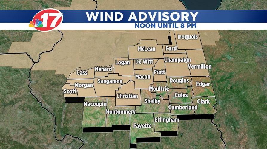
Ahead of this evening's storms, strong winds could gust to 45 miles-per-hour or higher. A "Wind Advisory" covers much of Central Illinois from noon Tuesday through 8 p.m.

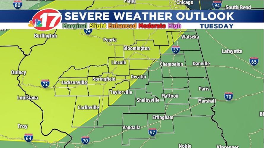
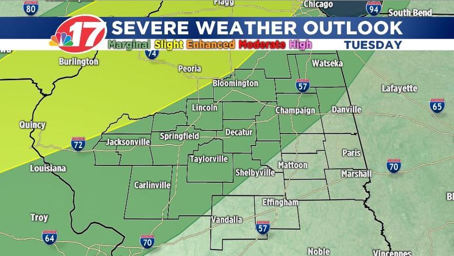
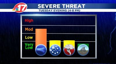
A thin line of strong to severe storms will race across the area from 4-8 p.m. The biggest threat for us will be damaging winds of 60 miles-per-hour or higher. To our northwest, there could be some isolated tornadoes.

Sunshine and much cooler air returns for the rest of the week with highs in the 50s and lows in the 30s.


